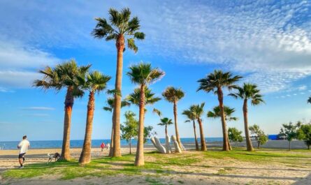

Portugal is a very picturesque country thanks to the ocean, small towns, golden beaches, and stunning Lisbon and Porto. The cuisine is delicious and they make unique wines. And it’s also very safe to walk here. I’ve done it many times and I can advise you from my own experience.
Hiking routes in Portugal are a good idea for those who want to see the real country and avoid the crazy crowds of tourist cities. Hiking in Portugal is not only about enjoying panoramic views and watching wildlife. This includes a well-developed infrastructure: from signs and markers on the routes, and websites where you can see all the necessary information, to the ability to create a route with comfortable overnight stays in in inexpensive hotels and hostels.
Here is a short list of the best hikes in Portugal. But first, the weather is important.
Last news about hiking in Portugal: Palmilhar Portugal – 3000 km on foot in Portugal
When is the best time to walk in Portugal
When choosing a time for a walking tour in Portugal, focus on spring and fall. Exceptions – if you are planning to walk in the south, winter will not disappoint you: you will have cool but mostly pleasant days and you will enjoy the welcome lack of crowds wherever you go. But keep in mind that in winter the day is short, which means you need to plan short transitions.
Camino de Santiago Portugues
240-600 km, 10-30 days, moderate difficulty
route website: www.gronze.com

The famous Camino de Santiago pilgrimage route can be walked not only in Spain. One of the variants of the Camino, which is also the most popular, is the Portuguese Camino, which is walked by thousands of pilgrims from all over the world every year. In fact, there are several of these routes – the first and main one, starting from Lisbon takes about a month and about 600 km.

But a shorter and more popular one is from the city of Porto It takes 8-10 days, 240 km. The Portuguese Camino from Porto is also divided into two options: The Central Portuguese Route, which goes from Porto, Barcelos, Ponte de Lima, Valens do Minho, Tui, Pontevedra, and Padron. The Portuguese Coastal Beach is a more touristy beach that leads along the ocean coast from Porto to the border with Spain, then Bayonne, Vigo, Pontevedra and Padron in Spain.
Very convenient infrastructure on the route, many pilgrimage hostels, stunning views, delicious seafood and the finale in the Spanish city of Santo de Compostela in the Cathedral of St. James.
I recommend to read: Dolomites – hiking along the most beautiful routes
Via Algarviana
300 km, 2-3 weeks, moderate difficulty
website of the route: viaalgarviana.org

If you are tired of relaxing on one of the most beautiful beaches in the world beaches of the Algarve, take a walk along part or all of the 300 km Via Algarviana. I think it’s the best way to see the beautiful scenery of this region.
The trail stretches fromAlcoutim in the northeast near the border with Spain to Cape Cabo de São Vicente in the southwest. Some of the most beautiful areas are around Monchique, with magnificent views from the hills where cork groves grow.

For starters, you can try a two-day route: start in Monchique, climb to Picota and back in one day, and then climb to Fóia and back the next.
Tip: Avoid walking along Via Algarviana in summer, when temperatures can be extreme and forest fires can be dangerous.
The route of the seven hanging valleys
5.7 km one way, 2-3 hours, moderate difficulty
website of the route: Percurso dos Sete Vales Suspensos

The central Algarve coast is the starting point for one of the most beautiful boat trips on the Iberian Peninsula. Colorful rock formations, the smell of salty air and the sound of crashing waves create a fascinating walk along the coastal cliffs.
This walk is most impressive if you start early in the morning or in the afternoon. But, to tell the truth, there is no bad time to go. Even if you’re traveling in the heat, you can cool off in the ocean water at the beaches along the way. Or wait for hours in the heat at the magnificent Praia da Marinha at the end of the trail.

Don’t miss the opportunity to take vivid photos at the Alfanzina Lighthouse or the wind-carved arches jutting into the ocean at Praia da Mesquita Beach. The walk also takes place near the Benagil Cave, but if you want to see it from the inside, you need to go down to the Praia de Benagil, where you can book a boat trip.
Piódão do Foz d’Égua route
6.8 km, 2 hours, moderate difficulty
website of the route: Piódão do Foz d’Égua

The journey to the tiny village of Piódão takes place deep in the Serra do Asor Mountains, a remote range with steep slopes, deeply cut valleys, rivers, and virgin forests. This particular village is extremely atmospheric – it is located among steep terraced slopes, built up with gray slate houses perched on green hills.

But the village is very famous, so there can be a lot of tourists here. To get away from the crowds and enjoy the tranquility of this wonderful region, take the short signposted trail to the nearby village of Fox d’Égua, where you’ll find beautiful old stone bridges, slate houses and a footbridge over a river gorge. You can return along another path with a view of the green landscape.
Passadiços do Paiva route
8.7 km one way, 3 hours, moderate difficulty
route website: www.passadicosdopaiva.pt

The Aveiro region of northern Portugal is home to one of the country’s best hiking trails. The Passadiços do Paiva is a network of wooden stairs and paths that run along the hillsides. They overlook the Paiva River. Enjoy the beautiful views of the rocky valley while having the opportunity to cool off – there are three river beaches along the route. At the end (or beginning) of your trip, you can optionally visit Ponte 516 Arouca, the world’s longest pedestrian suspension bridge.

This walk requires preparation. The walk takes place on the territory of the Arowka Geopark, so you need to buy a ticket (at a very reasonable price). The easiest and cheapest way to book is online. You will also need your own or a rented car to get to the trailhead – there are no buses to get there. You can start with either Areinho or Espiunka. And at the end, take a taxi back to the starting point. If you plan to walk only one way, it is better to start from Areinho to make the route less stressful. If you plan to hike round trip, you should start from Espionka and tackle the more difficult parts of the route first.
Route along the Roman road Via Geira
4.3 km, 1-2 hours, easy difficulty

One of the unforgettable places to hike in the Peneda-Gerês National Park is Via Geira. This is an ancient Roman road that once stretched for almost 320 km between Braga and Astorga (Spain). And now it has the status of a UNESCO World Heritage Site. The most beautiful section begins near the Portela del Hombre, where the Roman pillar XXXIV still stands.
From the milepost you can go southwest, going down along the Rio Homem through the beautiful Mata de Albergaria forest. This entire stretch is dotted with Roman signs, some of which bear the name of the emperor during whose reign they were erected.
Roca da Penha route
6.6 km round trip, 2-3 hours, moderate difficulty
website of the route: Roca da Peña

The shortest walk on Serra do Caldeirão is a climb up this limestone slope along a well-marked path. The area is home to 450 different plant species, including native daffodils and bee orchids. Among the birds, you can see a serpentine eagle, an Iberian green woodpecker, and an Egyptian vulture. Don’t miss the optional detour to Talefe, the highest point in the Roca da Penha at 479 meters (1,571 feet), which offers breathtaking views of the Algarve‘s interior.
The Salira, Alte, and Kerensa museums have a basic guide map that you can ask for before the start of the route. Take water and snacks with you (the only stops for refreshments on the route are small cafes at the base and in the village of Peña) and pay attention to warnings about seasonal forest fires. Roca da Peña is also popular with rock climbers.
Rota Vicentina
226 to 263 km, 12 days, above average difficulty
website of the route: rotavicentina.com

The Rota Vicentina consists of two hiking routes: one along the coast and the other inland. The route stretches along the southwest coast to Cape Cabo de São Vincente. The Coastal Walk (more commonly known as the Fisherman’s Trail) utilizes trails left by surfers, beachgoers, and fishermen. It passes through some of Portugal’s most dramatic coastal scenery. The inland route (the Historic Route) is equally attractive and passes through villages, cork forests, and river valleys. And then the two routes will combine and end at the lighthouse on Cape San Vincent on the southern coast, where both routes combine.

Both trails consist of sections, and there are rarely more than 25 km between villages where you can stay overnight. Therefore, there is no need to bring hiking equipment. The fishing trail has 13 sections with a total length of 227 km, and the walk is a bit more difficult with passages through sand dunes. Sometimes it runs along the rocks, is mostly single-track, and only pedestrians are allowed to cross it. The longer Historic Route consists of 13 sections with a total length of 263 km. The trails are wider and easier to walk, and you can even go mountain biking.
If you are interested in my experience – I advise you to read Rota Vicentina – my experience on the Fishermen’s Trail
Useful articles and links:
- Camino de Santiago – how to prepare for the pilgrimage?
- Via Francigena – Italian Camino, route details from Lucca to Rome
- Trekking to Everest Base Camp – how to prepare to hike in the Himalayas
Find train tickets in Europe conveniently on Trainline
Booking of hotels and apartments – Booking.com