
Hiking in the Dolomites – three most beautiful routes for one day and business cards of the Italian Alps. Recommendations and features of the routes.
What’s the best thing in the world to put your mind in order? For me, it’s the mountains and the ocean.
The ocean is quite far away, so we chose the mountains – the Dolomites, which have long been on my varsity list. So we got in the car, packed up our camping gear, bought food for ourselves and the dog, and set off on a week-long trip from Prague to Italy.
During five full days in the mountains, we managed to walk several radial tracks, camp in a tent and a hut, enjoy the sun, see snow on the peaks, and relax in the SPA.
Summer in the Dolomites – when is it better to go
Summer is the season for hiking in the mountains, but the weather is different in the summer months. We were in the Dolomites in early June – we were lucky, so it was only raining and cloudy for one day. But this can happen in July and August – these are the mountains, and the weather changes quite quickly. The temperature in the mountains varies from +28-35 ℃ during the day to +5-20℃ at night. Depending on the altitude at which you spend the night and the month you go to the mountains.
But August is considered drier, as is September, so there are a lot of people in these months. Especially in August, because it is also a traditional month for European vacations. The weather is good, but the prices for housing are enormous! Campsites are booked in advance – 2-3 months in advance, and hotel prices go up to the sky, because these are mountains )))
September is less hot and crowded. Compared to June, the weather in September is a bit drier, and there is no snow on the peaks. In June, at altitudes above 2500 meters, you can still find trails covered with snow.
Hiking in the Dolomites – the most beautiful tracks for one day
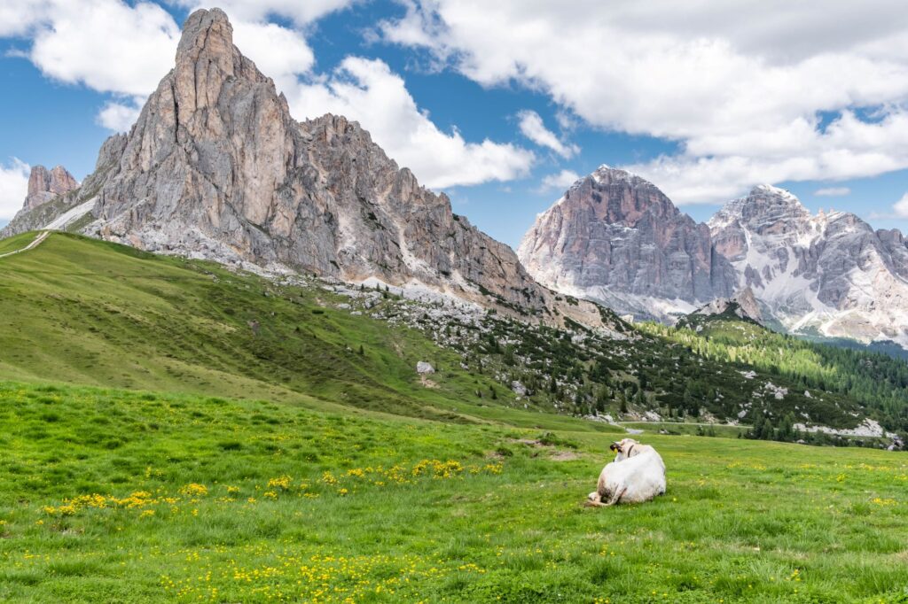
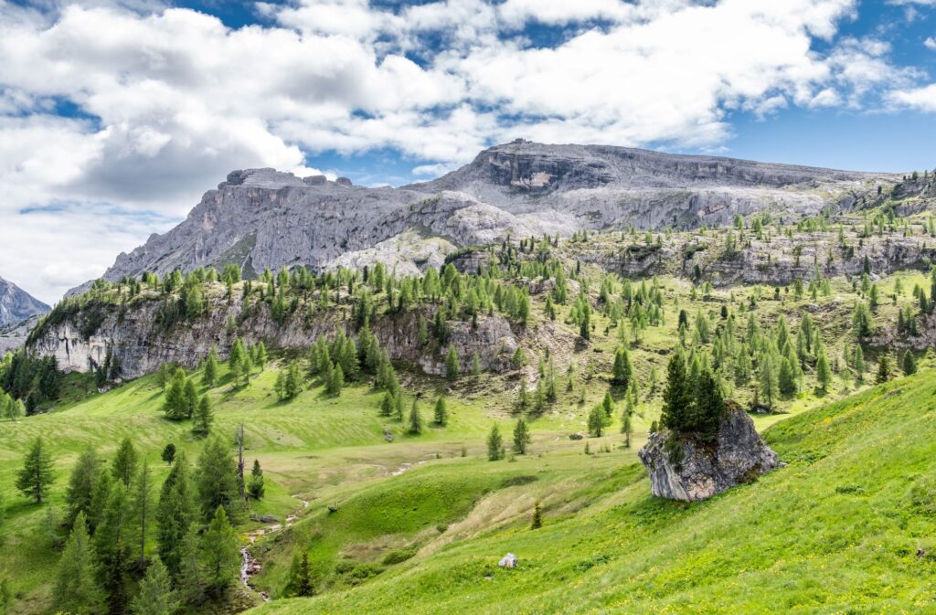
Why did I like the Dolmites?
First of all, these are very beautiful mountains. The photos speak for themselves. And secondly, there are many routes for one day – you don’t have to carry a backpack with all your things. You can drive your car to the start, leave the car in the parking lot and walk through the beautiful mountains all day. Some routes are paid for because they are very popular and are the Dolomites’ trademark. But most of them are free, and some trails can be accessed by ski lifts. But whether you pay for a lift or go up on foot is up to you.
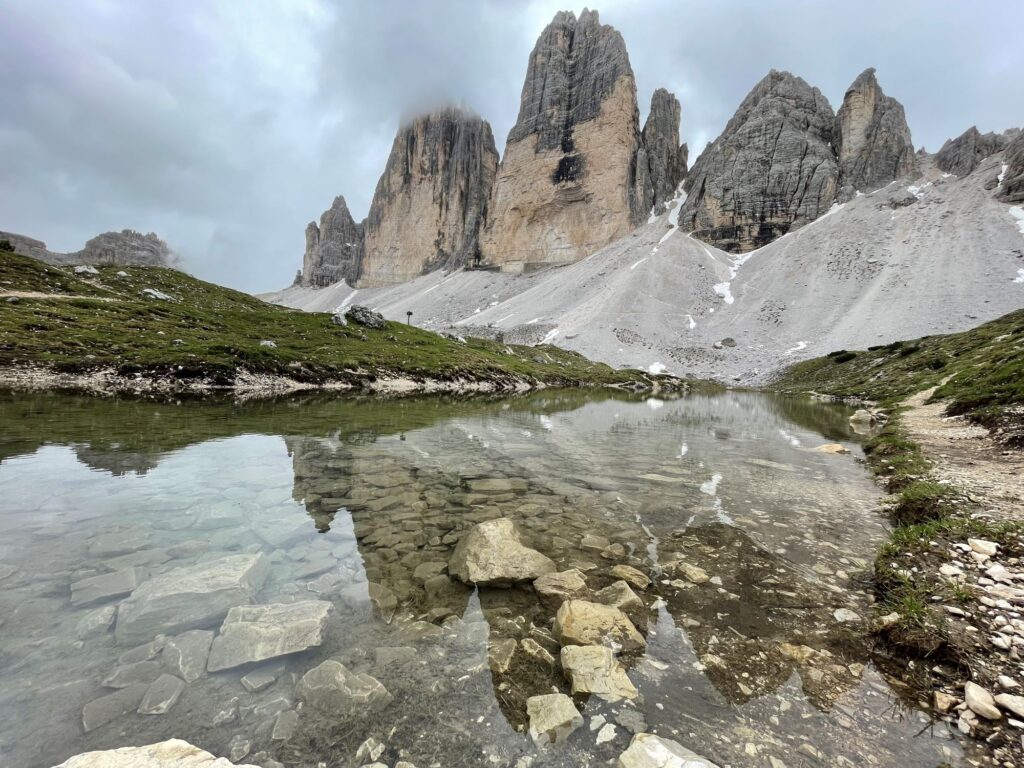
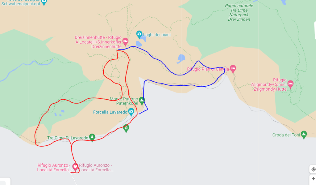
Track around Tre Cime di Lavaredo (2320 m)

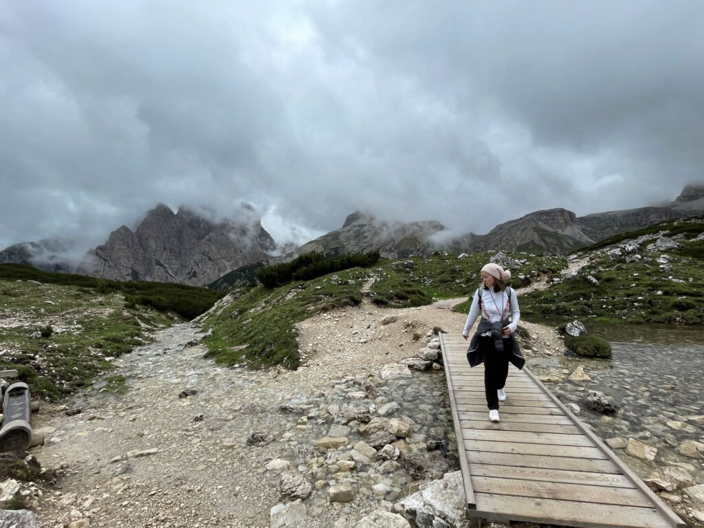
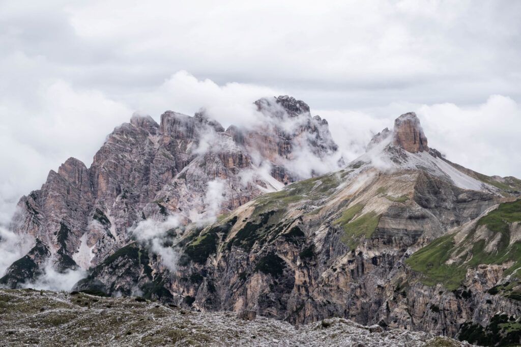
The three sharp-pointed rocks of Tre Cime di Lavaredo are the hallmark of the Dolomites. It is a grandiose rock massif that is featured on many local postcards. That’s why there are always a lot of tourists here in summer. But we were here in early June, and the weather was very cloudy, with almost no people on the trail. There was no sun that day – it was raining down in the valley below, and the clouds above made the mountains look very dramatic.
Despite the popularity of this track and the number of people who come here, this track should definitely be included in a trip to the Dolomites. But the grandiosity of the spectacle is such that the crowd “dissolves” in this fantastic space and there is a complete union with nature. Unfortunately, the camera cannot capture what we saw when we climbed to these peaks.
Tre Cime di Lavaredo route details:
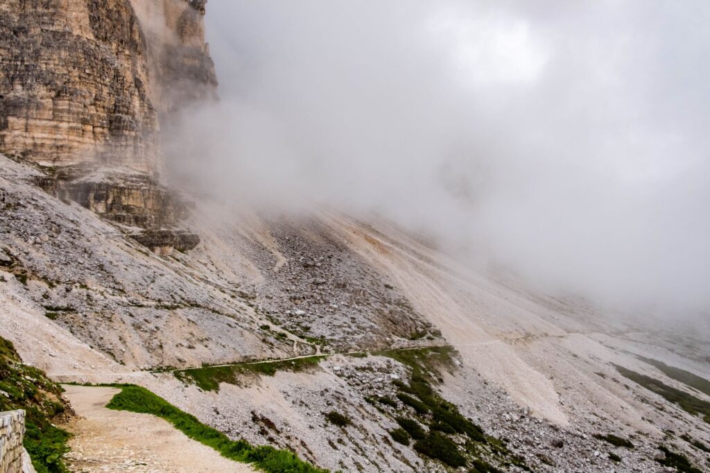
The beginning of the route (signpost #101) goes around the peaks on a wide, flat road (a former military road from the First World War), with almost no elevation gain. At first, the tops don’t look like their popularized images. Thanks to the clouds, we could hardly see them at first – only white mounds of stone, which are classic in the Dolomites.
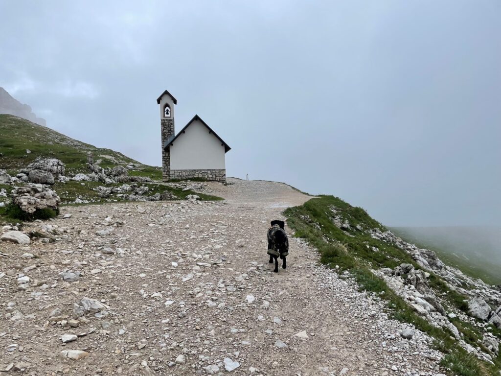
The majority of tourists start walking around the peaks counterclockwise , and we did the same. But after passing by the chapel built in honor of the fallen Alpine archers, we finally saw the grandeur and beauty of Tre Chime.

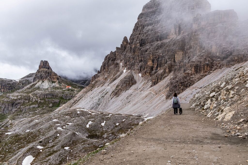
Then the route went along the traverse to the nearest shelter Rifugio Lavaredo, 2344 m, which is open from June to September. From here, the trail turns back, and the peaks of Tre Chime begin to gradually take on a familiar appearance that I had seen in photographs before.

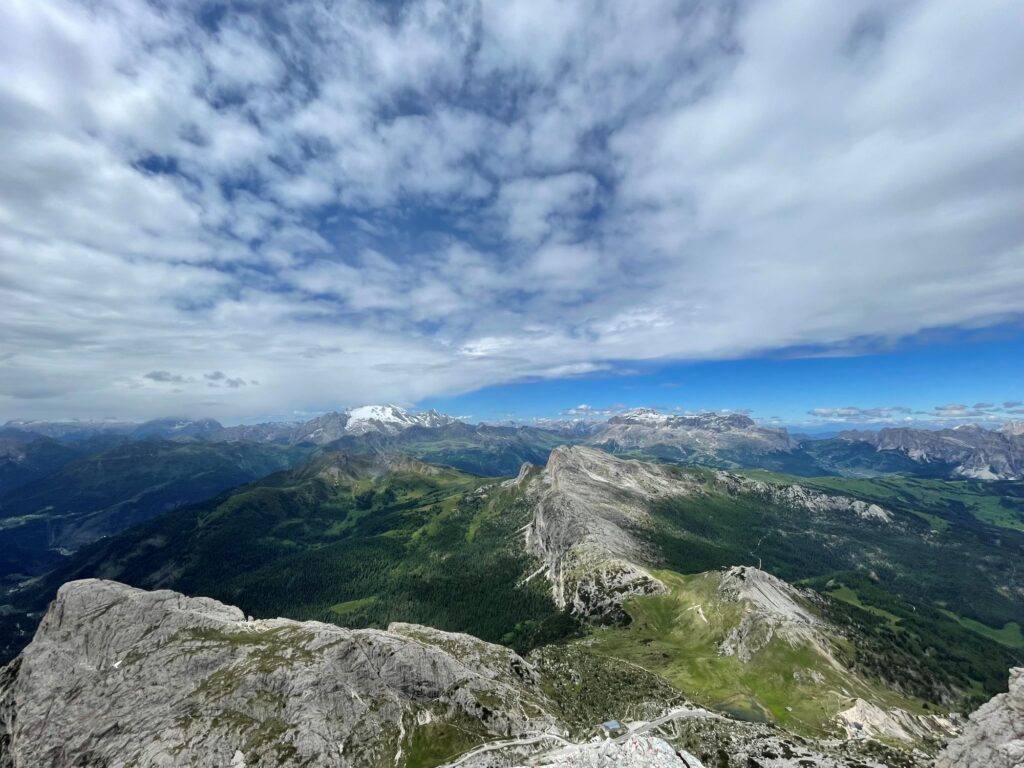
From the shelter of Rifugio Lavaredo, a wide path paved with stones goes up to the pass Forcella Lavaredo (2454 m, about 30 min. from the shelter). In the First World War, the saddle of the pass was an important stronghold of the Italian army. The pass saddle offers a magnificent view of both Tre Cime and the crest of Monte Paterno, the Tre Scaperi and Baranci groups.
The part of track from Rifugio Locatelli
Then, along the trail #101, the route traverses the slope of the Monte Paterno ridge, gradually descending and then ascending to the Rifugio Lokatelli shelter (2405 m, 45 minutes from the saddle of the pass), open from June to September.

From Rifugio Locatelli, trail #102 leads in a westerly direction. Going down to the upper part of the Plan da Rin basin for about 15 minutes, and then climbing back up to the opposite slope of the valley. Then the trail goes almost without gaining altitude around the peaks of Tre Chime, along the way there is a restaurant Langalm, stylized as a shepherds’ hut (2283 m).
From here, after a short climb and crossing a wide scree couloir, the trail ascends to the Forcella Vol di Mezzo pass (2135 m, about 1 hour). 50 min. from the Rifugio Locatelli shelter. And then in 10 minutes you can walk to the upper parking lot and bus stop near Rifugio Auronzo.
Useful information:
- Trekking poles are not needed here, as the elevation difference is minimal – up to 200 meters. Be sure to wear hiking shoes.
- Distance: 10-17 km, depending on the route you choose.
- Time: 3-5 hours, depending on the chosen route, weather, and your physical abilities (red track).
- Accessible by public transport: bus #444, which connects the rifugio Auronzo (2320 m) with the village of Misurina.
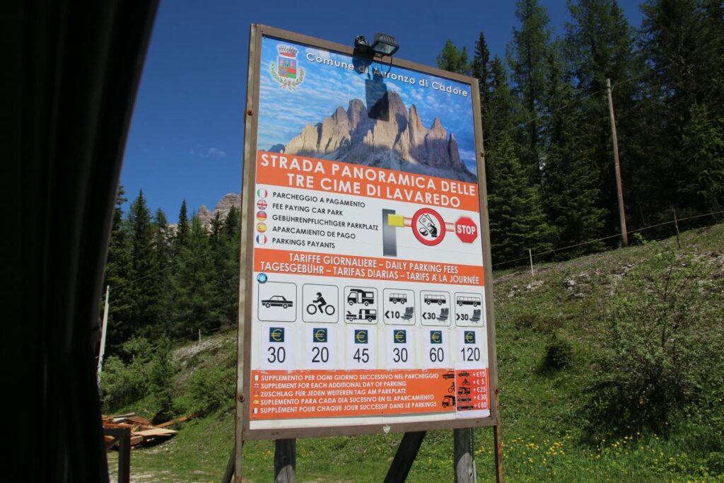
- Entrance fee: Free if on foot, by car – 30 Euros with a car, 10 Euros by bus.
- Hiking season: from May/June to September/October.
The track around Tre Chime is 10 km long. If you have time, you can add an additional 7 km to the Pian di Cengia refugia and near the Laghi dei piani lakes. The elevation difference is about 200 meters.
In July and August , be prepared for traffic jams on the serpentine road leading to the gate where they collect money for entry and for a lack of parking spaces at the refuge. In June, there were no such problems because it was just the beginning of the season, but on weekends there can be a lot of people.
Track around Cinque Torri (2361m)
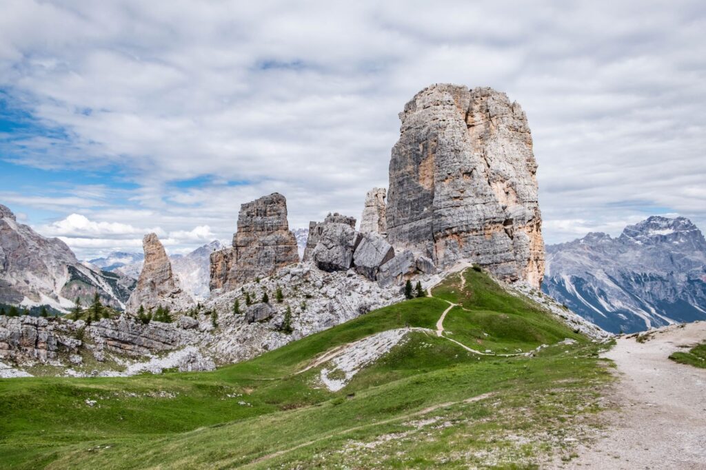
Trekking near the Cinque Torre, or Five Towers, is one of the easiest in the Dolomites. But it’s very beautiful, as far as I’m concerned, with many panoramic views of the Kopanik, Tofana, Cristallo massifs and the Cortina d’Ampezzo valley .

With so many stunning places in the Dolomites that make Cinque Terre special, you’ll may be surprised. There are two main reasons to come here. First, the most beautiful and easily accessible stunning views. And secondly, the history of the Great War and the Della Grande Guerra Museum, where you can visit the restored trenches of the First World War and learn more about their importance in the region during the war. Part of the Cinque Torre route is an open-air museum with information panels and outdoor exhibits related to World War I.
Details of the Cinque Torri route:

How difficult is the Cinque Terre hike? Some parts of the trail are very easy to walk, such as the asphalt section we used it to get to the foot of the cliffs by car (parking is free, but there are not many places for it). And other areas rise up and over the hillsides, offering breathtaking views. It takes about 2-4 hours to cover the entire distance, depending on the chosen difficulty and taking into account the time to explore the museum and stops for rest and refreshments.

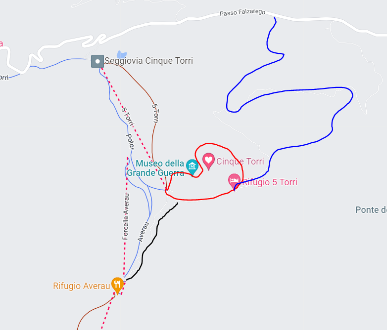
The Cinque Torri loop is a circular hike that starts and ends at the top station of the Rifugio Scoiattoli. But we started and finished it near the Rifugio Cinque Torri, where we parked our car. It passes by the sites of the First World War, bypasses 5 towers, past the Rifugio Cinque Torri and returns to the starting point. It is marked in red on the map below. The route takes 2 hours.
When you get off the cable car, turn left and you will see signs to hike the trail to the Great War Museum of Chinkwe Torri. Next, I suggest taking a walk around the towers, where you can see climbers climbing the steep cliffs. The views from the other side of the towers are very different, and it is absolutely worth the entire route.

If you have the strength and desire, you can add the ascent to Rifugio Averau (2416 m – marked in black). We need to add a couple more hours to this.
Useful information:
- Trekking poles are not needed here, and the elevation difference is minimal – up to 200 meters. Be sure to wear hiking shoes.
- Distance: 2-4 km, depending on the route you choose.
- Time: 2-4 hours, depending on the chosen route.
- Accessible by public transport: bus that connects Cortina d’Ampezzo with Passo di Falzarego.
- Entrance fee: Free, except for the cable car (optional).
- Hiking season: from May/June to September/October.
Start and end point: Rifugio Scoiattoli (accessible by cable car or on foot) or Rifugio 5 Torri (accessible by car, the road is marked in blue). Parking is free, but there are not many parking spaces – keep this in mind. If you want, you can go up on foot either on steep ski slopes or on a narrow asphalt road (the one marked in blue). You can also go to the trekking by cable car, which leads from the track to the refugia and the Rifugio Scoiattoli restaurant at the top station (2255 m). A round-trip ticket costs 17.5 euros.
Lago Lagazuoi track

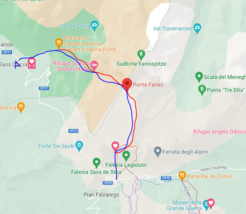
This track is named after the Lago Lagazuoi lake, which is located under the majestic walls of Cima del Lago, Cima Scotoni and Fanis. We chose it because it starts almost from the gate of the campsite Camping Sass Dlacia where we stayed for five days during our trip to the Dolomites.
Lago Lagazuoi route details

The track starts from the parking lot near the Rifugio Capanna Alpina (1726 m), from which you need to climb the ski slopes to the Scotoni Hütte ( 2040 m). Here you can have a coffee or a snack. Or you can just take a break and talk to the local alpacas.

From there, the trail goes steeply up stone and wooden steps to Lake Lago Lagazuoi. This beautiful alpine lake is located at an altitude of 2182 m, nestled among the steep slopes of the Dolomites. Its crystal clear water turns different colors depending on how the sun’s rays fall on it. The lake reflects the peaks of the Dolomites: Torre del Lago (Piz d’Leh) and Scotoni Peak. By the way, there are fish in the lake – the fry pinched my fingers.

You can go down the same way (red route on the map). Or you can choose an alternative version of this route – start with the Lagazuoi cable car (blue route). The lower station of the Lagazuoi cable car is located on the Falsarego Pass, which can be reached by car. There is free parking near the cable car. Or you can take bus #465.
Once you reach the top near the Lagazuoi refugio (2752 m), take route 20. It runs along Lake Lagazuoi, the whole hike is a continuous descent, with some steep sections, but not too difficult. You can do it even with children, but this route is not suitable for strollers or mountain bikes.

After relaxing at the Scotoni Hut, head down to the Rifugio Capanna Alpina and then onto the piste, where you’ll find a bus stop. Take bus #465 to return to the car you left in the parking lot near the ski lift. The one-way lift costs 15 euros.
Useful information:
- Trekking poles will come in handy here, as there are steep ascents and descents. The altitude difference is up to 1000 meters. Be sure to wear hiking shoes.
- Distance: 10 km, depending on the route you choose.
- Time: 3-5 hours, depending on the chosen route, weather, and your physical abilities (red track).
- Accessible by public transport: bus #465, which connects the parking lot near the Lagazuoi cable car and the end of the trekking on the track 1 km from Rifugio Capanna Alpina
- Entrance fee: Free if on foot, 15 Euros one way on the lift.
- Hiking season: from May/June to September/October.
Recommended: Details of a road trip to the Dolomites.
Useful articles and links:
- The best hiking routes in Portugal
- Rota Vicentina – walking route in Portugal along the coastline near the Atlantic ocean
- Via Francigena – Italian Camino, route details from Lucca to Rome
- Verona – what to do in the most romantic city in Italy
- Chamonix – holidays in the Alps with a view of Mont Blanc
Booking of hotels and apartments – Booking.com
Car rental – I am looking for inexpensive options on Rentalcars.com