When people talk about Malta, they most likely mean a maritime and cultural vacation. When I told my friends that I was going to Malta, including for hacking, they looked at me in surprise.
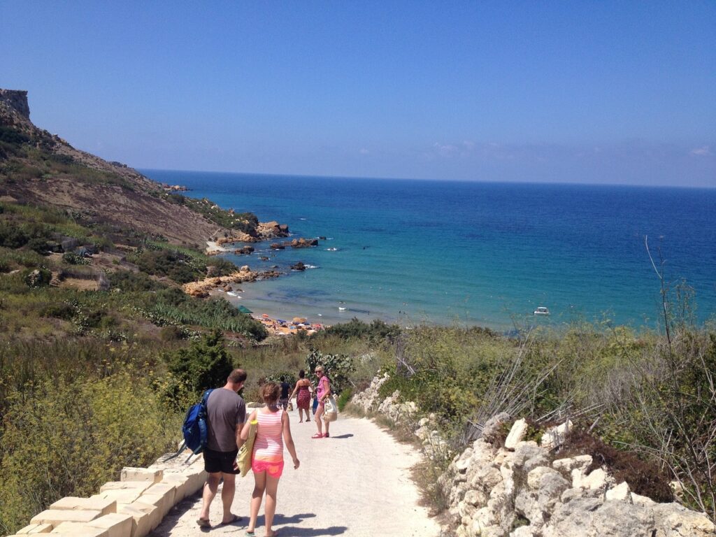
Yes, there are no mountains in Malta, and hiking is almost in its infancy. Although there are very few hiking trails on the islands, there are trails that are used by lovers of walking along the sea and cliffs.
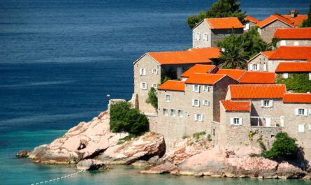
Despite its low popularity, a walk along the coast of the islands of Malta, Gozo, and Comino is a visual treat with views of vertical sea cliffs and secluded blue bays.

Another good reason to go to Malta is that the hiking season lasts from late fall to early spring. For me, going somewhere warm in the winter where you can walk with a small backpack under a clear blue sky is a very good idea for a reboot.
I arrived in Malta in mid-February and the weather was mostly sunny. Only on the first day there was a short thunderstorm, and then for two days there was quite a strong wind. But the sun was shining, the flowers were blooming, and the trails were extremely calm.
I’m going to tell you about hiking routes and my own experience of hiking on the islands of Malta, Gozo, and Camino.
What you need to know about hiking in Malta
Season: Late October – early May. Avoid the summer months for long hikes in Malta as temperatures are very high.
Marking: The wayfinding is sporadic and inconsistent. Waypoints are usually red, blue, or yellow dots and arrows. There are signs about private property on some roads. But the Maltese Rambler’s Association defends the public’s rights to public paths and other passages that have been trodden by people for centuries. In addition, many existing trails pass through private land or hunting grounds. But not all of them are installed in truly private places. Even with a guidebook, you may come across newly installed “Private Property” signs that prevent you from walking freely. But not all of these signs are legal.
Safety: Coral limestone cliffs are quite fragile and don’t have any protection of age. Keep a safe distance from the edge of the cliff. By the way, there are no wild dogs in Malta and Gozo – only free cats, which are fed, and have small houses which people built for them.
Hiking equipment: I used a 20-liter backpack that I flew to Malta with. So my things were with me almost all the time. Shoes – Hoka sneakers, in which I walked 420 km of the pilgrimage route a year ago Via Francigena in Italy. They are very comfortable and convenient, and it was dry and warm in Malta – perfect for lightweight shoes. I use trekking socks – that way I won’t get blisters. It is advisable to wear sunglasses and a hat – the sun shines brightly during the day, even in February. I also used sunscreen – it is relevant even in winter. During the day, I wore a T-shirt, and in the morning and evening, I wore a hooded sweatshirt and a light jacket.
Hiking routes on the island of Malta
There are many hiking trails on the island of Malta, and I didn’t have enough time to go through them all, unfortunately. But I will describe the ones I liked.
From Golden Bay to Gneina Bay
- Distance between Golden Bay – Gnejna Bay: 6 km
- Travel time: 2.5 hours
- Getting there: bus #44 – Valletta, #101 – Ic-Ċirkewwa, Mgarr, #223 – Bugibba, #225 – Sliema Ferries/Valletta, TD5 Tas-Sliema.
Golden Bay is located on the northwest coast of Malta, near the village of Manikata. A short but beautiful loop trail leads from Golden Bay to Gneina Bay, passing various beaches and coastal watchtowers.
To start this hike, head down to Golden Bay Beach. There is a pedestrian path that connects the southern part of the beach with the footpath on the rocks. After reaching the cliffside footpath, continue south to the Għajn Tuffieħa Tower, which overlooks the Għajn Tuffieħa Bay.
From the tower, the trail heads inland to the Għajn Tuffieħa Bay parking lot, passing a coffee shop that serves a tempting selection of hot and cold coffees. Several trails lead from the parking lot to the south parallel to the Għajn Tuffieħa beach and lead to the narrow neck of Cape Il-Qarraba. The path is mostly free, but there are a few places painted with red signposts, but there are few of these markers on the trail.

After completing the lap around Il Karrab, go to the Gneina Bay. The return trip can be the same, or continue north on a wide path that goes away from the sea, starting from Qarraba Bay.
I really enjoyed the sunset in Golden Bay. If you plan such a route, keep in mind that it is better to do it in the afternoon to watch the sun set into the sea.
Route along the Dingley cliffs

- Distance from Dingli to Dingli cliffs viewpoint: 3.5 km
- Travel time: 1.5 hours
- Getting there: bus #201 – Rabat – airport
This route is very simple – even children walk here with their parents. Almost all the time you walk along the hiking trail along the highway (buses run here once an hour) and along the cliffs above the sea. The views are magnificent, there are benches over the rocks – you can stop and sit, looking at the sea and the rock island of Filfla, located off the coast of Malta.

On the way, you will see an airborne radar tower with a white dome, as well as a small chapel – St. Mary Magdalene Chapel on the cliff. But, as for me, the best view of the Dingley cliffs can be seen from Viewpoint near the Zuta bus stop (35°50’39.9″N 14°23’54.7″E). Here, on a small promontory, there are ruins from which the Dingley Cliffs are best seen – they are beautiful.
Hiking routes on the island of Gozo
I walked around the island of Gozo more than Malta – there are very beautiful cliffs and routes along the sea. So here are my favorites.
Route along the coast of the Bay of Dwejra

- Distance from Dwejra Bay to the south and north: 13 km
- Travel time: 5-6 hours
- Getting there: bus #311 – Victoria – Dwejra
Everyone knows Dwejra Bay from the Game of Thrones series – it was here that Daenerys and Khal’s wedding took place against the backdrop of the Blue Eye stone arch. The arch was destroyed by a storm in 2017, but the bay still remains unsurpassedly beautiful thanks to the rocks that surround it.
There are places to walk and things to see. There are trails to the north and south that take you along the sea and cliffs.

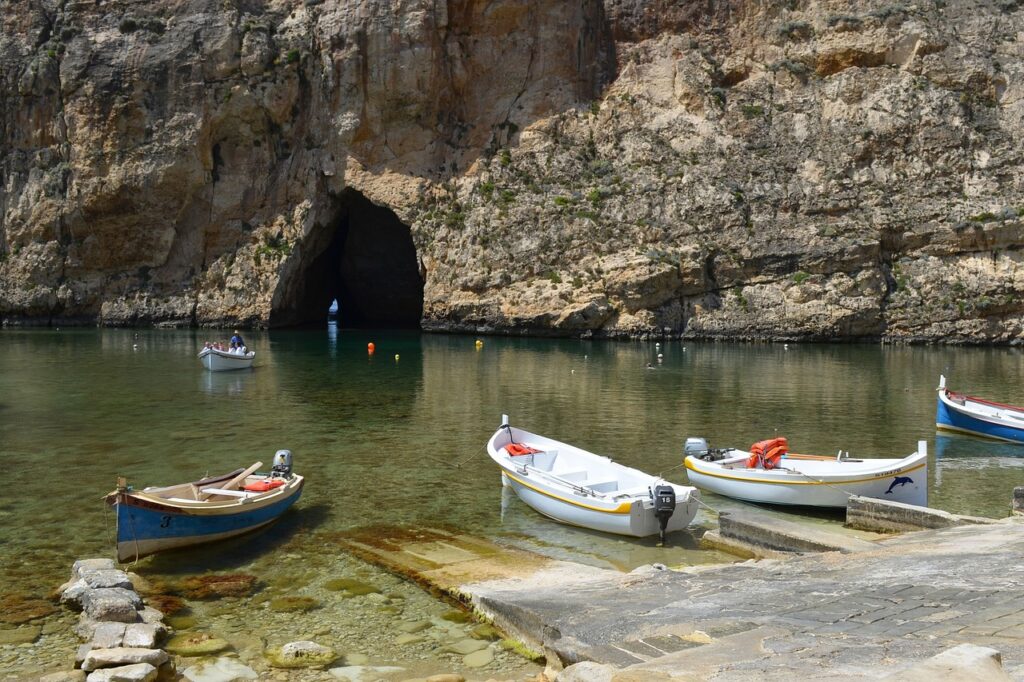
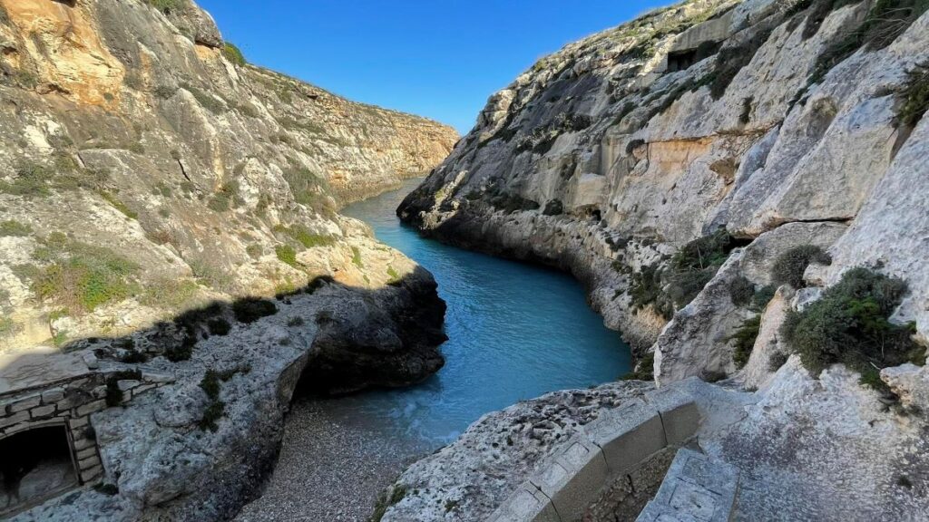
To the north – starting from chapel of St. George. Annie. The trail climbs upward, offering bird’s-eye views of the Inland Sea of Dwejra, a lagoon connected to the sea through a natural tunnel. Go up the stairs carved in the stone and then turn left – where there is a red arrow. This is the direction of the rocks. The cliff-top trail runs along the coast for 2 km, indicating from time to time marked in red. The route ends at the sign “private property”. You can return by the same route – in total, you will walk about 6 km in both directions.
Start from the upper parking lot and follow the trail south to the coastal watchtower. Go past the tower and continue until you reach a stone wall (perimeter of private property) and a printed sign “Go this way”. The coastal path offers stunning views of Dwejra Bay, Fungus Rock and the sea. Similar to the northern trail, the path ends abruptly at an observation deck overlooking Xlandi Bay. You can return by the same route – in total, you will walk about 7 km in both directions.
Route from Mgarr Harbor to Ta’Senk cliffs

- Distance from Mgarr Bay to the Ta’Senk cliffs: 7.5 km
- Travel time: 2.5 hours
- Getting there: bus #305 Victoria – Sannat
I walked this route as soon as I arrived on the island of Gozo, as soon as I arrived on the ferry in Mgarr Bay. The walk was great – it was easy for me to walk, and there were a couple of places along the way where it was nice to stop for a rest. I highly recommend this route for those who come to Gozo without a car. You don’t have to leave your car in the parking lot, you can walk and take a bus to the city of Victoria at the end of the route.

This short and pleasant walk along the coast starts at Mgarr Harbor and ends at the cliffs of Ta’Senk. The trail is varied – sometimes it is very narrow and sometimes passes over rocks, sometimes it turns into a dirt road. You can see red markings in the form of arrows and bold dots on the stones everywhere.
The trail hugs the coast, passing by several picturesque bays, such as Xsatt-L-Ahmarr Bay and the beach on it. The trail also goes through the picturesque bay of Mġarr ix-Xini, located approximately in the middle of the route. The movie “By the Sea” with Brad Pitt and Angelina Jolie was filmed in the bay. There is a small beach and a cafe (closed in winter), a very nice place to stop and relax before moving on.

Next, you need to climb the slope and walk a little away from the sea for a while to reach Ta’Senk and the observation deck with a stunning view of the cliffs. The Ta’ Cenc Cliffs observation deck is privately owned. However, access is allowed.
Reaching a height of 138 meters above sea level, the Ta’Senk cliffs are the highest sea cliffs on the island of Gozo . These sheer limestone cliffs are located along the southern coast of the island, near the village of Sannat.
Route from Bay of Qbayar to Bay of Wade il-Ghrashi

- Distance from Qbajjar Bay to Wied il-Għasri: 3 km
- Travel time: 1.5 hours
- Getting there: bus #310 Victoria – Marsaflorn, #309 Zebbug – Victoria
This is a small but interesting and intense route that leads along the sea. Start at the final stop of the 310 bus, which is located in the bay Qbajjar Bay. From here, the trail goes along sandstones, and then the salt mines, which are made in this soft stone.
Then, following the path along the sea cliffs, you will find yourself in the bay Wied il-Għasri – a very beautiful place where the blue water enters a narrow rocky gorge – a real canyon – to end up on a small stone beach.
If you have the time and desire, you can walk further to the stone arch of Wied il-Mielaħ, a small copy of the destroyed Blue Window. But keep in mind that part of the route goes through private territories – you may have to go around the hill where the Ta’ Ġurdan Lighthouse is located.
Route around the island of Comino

- Distance in a circle from the Blue Lagoon and back: 10 km
- Travel time: 2.5 hours
- Getting there: by ferry from Malta or Gozo
I advise you to walk around the island, see the Santa Maria Tower, go to the Santa Maria Bay – there are almost no tourists here. Along the way, you will see the Chapel of Our Lady’s Return from Egypt, the Santa Maria Battery, and the Iż-Żerżieqa Stone Arch.
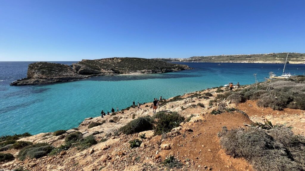
Comino Island is small – it will take you no more than 2-3 hours to walk around it. But you will see its pristine shores – without the crowds of tourists who stop only at the Blue Lagoon.
Useful links for traveling to Malta:
Car rental – I am looking for inexpensive options on Rentalcars.com
Booking hotels and apartments – traditionally on Booking.com
Travel insurance with discounts – online on the portal EKTA
Excursions in Malta – book in advance on GetYourGuide
Buses in Malta and Gozo on the website of the transport company of Malta.
High-speed ferry from Malta to Gozo – tickets are available at the ticket office or online on the port’s website.
What else to read:
- Tropea – beach vacation in Calabria, Italy
- Malta – how to plan a trip for 7 days
- Algarve – the best beaches in Portugal
- Transportation in Malta – the best way to get around the islands