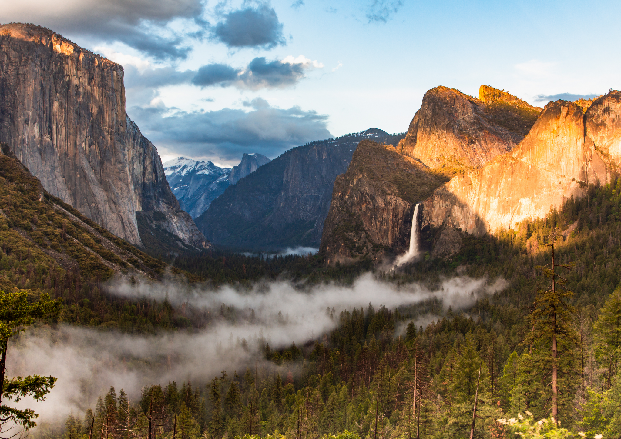
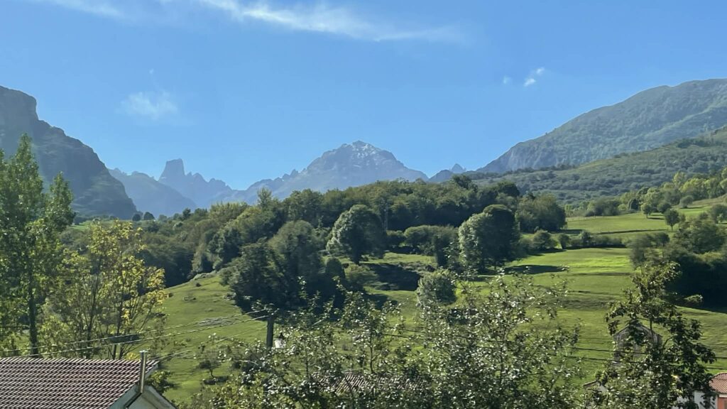
Another dream has come true—a journey in the Spanish mountains of Picos de Europa, which I combined with several very beautiful towns by the ocean. These wildly beautiful mountains are located at the junction of three Spanish provinces: Cantabria, Asturias, and León. The route I took is of medium difficulty—this is hiking without climbing, on well-marked trails in the mountains and along the ocean coast.
Such a combination gives the best feelings from a trip to this part of Spain. The mountains and the ocean both literally take your breath away. The nature is gorgeous and little-known outside Spain. If you love the Dolomite Alps and have already visited the Atlantic coast of Portugal—it’s time to discover northern Spain.
I invite you to dive into my route; I’ll explain how best to plan your trip and get the most from the experience.
Picos de Europa – where the National Park is located

Picos de Europa is a mountain range in northern Spain and an eponymous national park, located in the provinces of Asturias, Cantabria, and León. The main summit, Torre Cerredo (2648 m), is the highest point in both the Cantabrian Mountains and Asturias. Climbing to the summit is considered “not very difficult” and doesn’t require special equipment or climbing skills. The first ascent of Torre Cerredo was by a group led by the French mountaineer, cartographer, photographer, and artist Aymar d’Arlot de Saint Saud on June 30, 1882. He also produced the first map of the Picos de Europa area.
As for the rather ambitious name “Peaks of Europe”—one version connects it to the fact that these were the first mountains visible to sailors returning to Europe from America. Another version says that pilgrims who walked the Camino de Santiago from central Europe found these high mountains reminiscent of the Alps, and they said “peaks like in Europe.” Locals, meanwhile, traditionally call them simply “the Peaks.”
In any case, Picos de Europa National Park is the second-most-visited in Spain, where you can hike, climb, go rafting, and observe diverse wildlife and plants. It’s very popular with Spaniards, and for some reason still little-known elsewhere. Maybe because you can still hike here cheaply, staying in convenient mountain refuges, small villages with hostels, hotels, and campsites.
I fell in love with the Picos de Europa mountains and really want to share my experience of hiking and traveling in these places.
How to get to Picos de Europa
The nearest airports to Picos de Europa are Santander Airport in Cantabria, Asturias Airport (also called Oviedo-Ranón, OVD) in Asturias, and Bilbao Airport in the Basque Country.
I flew to Bilbao from Barcelona, because at that time it was cheapest to fly from Chisinau to Barcelona and from there by Vueling straight to Bilbao (tickets to Santander were three times more expensive).
I started my route in the Picos after walking the Camino Lebaniego (from San Vicente de la Barquera to Espinama, from where I headed up into the mountains).
You don’t need to do this (that’s just my thing—walking Camino every year). Better rent a car to save time and not wait on public transport, or hike up first to the parking area where everyone leaves their car, and then start the mountain trails.
When to plan a trip to Picos de Europa

The ideal time to visit the “Peaks of Europe” is June through September. You can visit in August, but keep in mind it will be crowded. This is the sunniest time of year, which is when the most tourists come. It’s also when there can be wildfires that might interfere with your trip in the mountains.
If you pick June or September, you’ll find fewer people, so main sights (like hiking trails) will be more or less empty.
And if you love wildflowers and birdwatching, then consider coming here in April, May, or October—these are great months to spot endemic animals and flora.
I was in Picos de Europa in the second half of September 2025. The weather was simply perfect—it rained just once, and that day I hadn’t gone up in the mountains yet. On other days it was sunny, with temps of +20–22°C, and very comfortable for hiking with a backpack.
Stage 1: San Vicente de la Barquera – Potes – Monastery of Santo Toribio – Espinama
I did this route in five days while walking the Camino Lebaniego – read about it here. If you’re driving, you can see everything much faster. I highly recommend seeing these places—there’s plenty to discover.
However, if you don’t plan to walk this way, I recommend visiting Potes itself, the symbolic gateway to the Picos de Europa park.
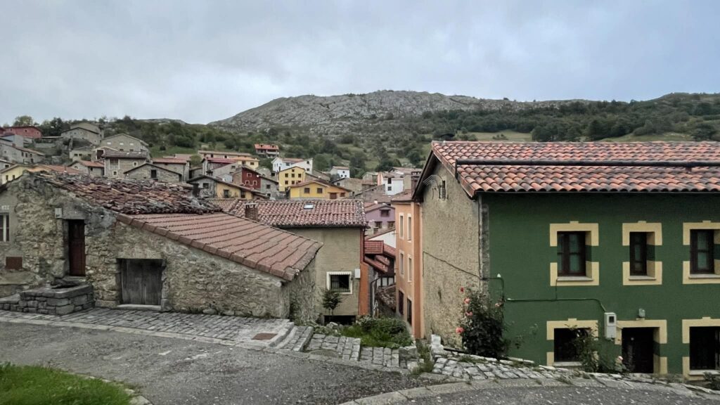
Potes

Potes is a town located 100 kilometers from Santander. It’s mainly known for its closeness to the Picos de Europa mountain range, so there’s usually no lack of travelers here. Potes is also called “the city of bridges and towers”: the unique atmosphere here will appeal to all lovers of the Middle Ages. The heart is the Old Town, where it’s nice to get lost among the labyrinth of narrow streets.
It’s easy to fall in love with Potes. This attractive town on the river features cobbled streets, stone bridges, and historic Casona montañesa houses. There are many restaurants serving traditional local and European cuisine. It’s also the gateway to the Valle de Camaleño and the Central Massif of the Picos de Europa.
What to do in Potes:

- The symbol of Potes, depicted on its coat of arms, is the Torre del Infantado, built in the fifteenth century to protect the city from attack. Today, the town hall is in the tower.
- Another clear landmark is the Puente de San Cayetano (San Cayetano Bridge) from the thirteenth century over the Río Quiviesa.
- Nearby are the Torre de Orejón de la Lama, now used for exhibitions and other cultural events.
- And the Ermita de San Cayetano chapel—with its interesting wooden doors.
- In Potes, the Quiviesa merges with the Río Deva, rising near the mountain village of Fuente Dé—I’ll take the Picos funicular from there later on.
- While in Potes you must try local specialties—especially cocido lebaniego chickpea stew. The town is also famous for its signature brandy orujo, made from grapes grown here. In November, Potes traditionally hosts a festival dedicated to this drink.
Potes is a very popular city in the Picos de Europa, if not the most popular. This old town is considered the capital of Liébana, a region that is a valley located between the Picos and the Cantabrian Cordillera (Cordillera Cantábrica).
How to get to Potes:

The easiest way is to come here by car. The N-621 road winds between the imposing limestone walls of the Hermida Gorge (Spanish: Desfiladero de La Hermida). This 22-kilometer gorge follows the Deva river in the Eastern Massif (Ándara) of the Picos de Europa. It is the longest gorge in Spain.
By bus from Santander: Palomera is the bus company that runs buses from Santander to Potes. They run 1–2 times a day. Check the schedule on Moovit.
Where to stay in Potes:
- Hostería La Antigua – clean rooms with nice beds, some with mountain views, great price for a tourist town.
- Maile Apartamentos – modern, clean apartments with mountain views. Ideal location, three supermarkets and many restaurants nearby, laundry/dryer available in the building (5 euro for wash / 2 euro for dryer—coins only).
- Hosteria Sierra del Oso – offers clean and tastefully decorated studio apartments in Potes. For maximum comfort, book a penthouse apartment with air conditioning. No on-site parking.
- Apartamentos Casa de la Abuela – offers great apartments with 1–2 bedrooms and well-equipped kitchens in a central but quiet location in Potes. No parking on site.
Monastery of Santo Toribio de Liébana (Monasterio de Santo Toribio de Liébana)

This monastery, located 3 km west of Potes, is important for two reasons. It houses the Lignum Crucis, believed to be the largest fragment of Christ’s cross. It is also the home of Beato de Liébana, a theologian and monk known for his meditations on the Apocalypse.
There is also a very beautiful panorama of the Picos de Europa Central Massif near the monastery; for me, it’s where the name of these mountains comes alive. From here, they look like a crown of limestone peaks—such a scenic spot.
Getting here is easy—30 minutes’ walk from Potes along a trail by the road, or 5 minutes by car (there is parking at the monastery).
Stage 2: Espinama and the Camaleño Valley – Fuente Dé

The Camaleño Valley stretches between Fuente Dé and Potes. It is essentially the upper valley of the Deva river. The valley is dotted with rural villages and farms, and crisscrossed by hiking trails. One of these I walked from the Monastery of Santo Toribio to Espinama—about 27 km through villages and along the Deva river.
This path is also the Camino Vadiniense, which starts at the monastery and goes through the mountains to the province of León. It connects the monastery with the most popular Camino Francés. I didn’t plan to walk all the way there, but I took the opportunity to walk part of it, since I wanted to hike every day (public transport is poor here, one bus per day from Potes to Espinama at 8 am). Of course, you can quickly cover these kilometers by car—but maybe I’ll do that next time ))

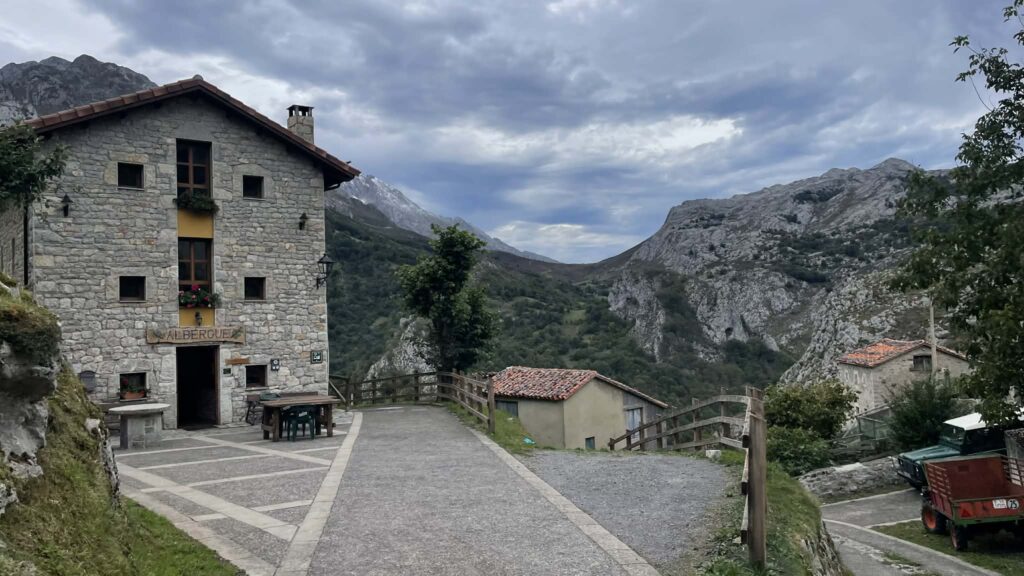
The most touristic town in the Camaleño Valley is probably Espinama, which has a big choice of accommodation, restaurants, and shops. I stopped here before heading up into the higher part of the Picos de Europa, for an overnight, because by the Fuente Dé cable car there are only expensive hotels. Espinama has very nice hostels and hotels—a choice for every budget.
Tienda Casa Clara is a charming bar-shop selling local specialties: cheeses, sausages, cider. I ordered a plate and cider here, it was very tasty and most importantly—they are open during the day when all the restaurants are closed until evening.
Where to stay overnight in Espinama:
Albergue Turístico Briz – a clean hostel in Espinama with dorms, a shared kitchen, and a garden. I stayed there for the night—I was the only one in the 6-bed room, because it was low season at the end of September.
Stage 3: Fuente Dé – cable car to the Picos – Sotres

The next day I had a climb to the highlands ahead. You can do this on foot right from Espinama, or ride “with the wind” on the Fuente Dé cable car. I chose the cable car, but by tradition I walked there, following the Camino Vadiniense trail and waypoints.
I was barked at by sheepdogs—I fended them off with my poles. Then I had a standoff with cows and calves standing on the trail in my way. But I managed to get around them and reached the Fuente Dé lift (1094 m), which connects the Camaleño Valley with the Central Massif of the Picos de Europa.
To be honest, at first I wanted to spend the night at the cable car hotel Parador Fuente De — it’s one of the chain hotels of Spain that they build in old buildings or in insanely beautiful places. I actually booked it in advance. But then, after calculating the cost of the whole trip, I switched to a hostel in Espinama, because I still had a lot of travel ahead and the budget isn’t infinite.
Fuente Dé Cable Car

The cable car is located in the eastern part of the park in Cantabria, the Fuente Dé cable car covers a 753-meter vertical difference and a total length of 1,450 meters. Many people use it just to enjoy the breathtaking views during the ride up to the El Cable mountain station, which is at 1,834 meters.

If you’ve used cable cars in Lisbon or other cities, this cable car is a mountain lift climbing hundreds of meters up, up, up. The views and speed reminded me of the cable car up Demerdzhi mountain in Crimea, or the lift in Montserrat near Barcelona. The cabin moves very fast—just 4 minutes for the ride. At the end, you get the feeling the cable car is about to crash into the rock wall. The mountain seems to come at you—what a wild sensation!
The “Mirador del Cable” viewpoint is located right at the mountain station. From this metal balcony-platform, you get a panoramic view of the Camaleño Valley, the main summits of the Picos de Europa Central Massif (Urrieles), and the Cantabrian Mountains.
Tickets for the cable car and facilities:

You can buy a ticket on the official cable car website (I recommend this if you’re hiking in the Picos in summer and can plan your time precisely). In autumn, you can calmly go to the ticket office—no lines, cabins run every 10-15 minutes, there’s space for everyone. Ticket price—€17 one way, €30 round trip.
The cable car operates all year round, so if you want to see the Picos de Europa in winter—that’s a great option. Or, if you don’t hike mountains, you can simply ride up and down, walk a bit on the plateau (it’s easy)—a perfect reason to use this transport.
Near the cable car there are free toilets, souvenir shops, a large parking lot, and a café—where you can start the day with coffee and an amazing view.
Route from the upper Fuente Dé station to Sotres village

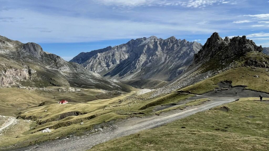
From El Cable, the trail gently rises through limestone rocks up to Horcada de Covarrobles pass. From here, incredible hiking routes begin—one of which I planned for exploring Picos de Europa National Park. From the pass, the PR-PNPE-24 trail descends to Refugio Áliva hotel.
This is a very picturesque trail and quite an easy walk, which brings much pleasure in nice weather. At the El Cable mountain station, you’ll find amenities like public toilets and a cafeteria.
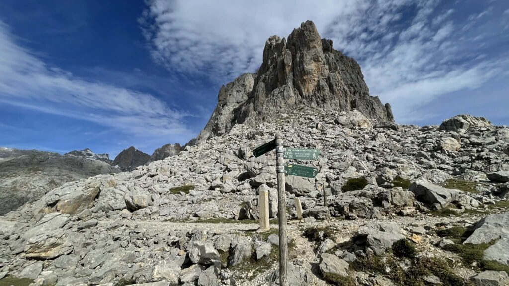
With a view of the bare limestone mountains, follow the well-laid trail north to Horcada de Covarrobles pass (1933 m). At the pass, there’s a signed junction. The left trail goes to Horcaos Rojos (PR-PNPE-23), while the right leads to Refugio Áliva. If you need Sotres or want to do a circular route down to Espinama, go toward Refugio Áliva.
The wide trail crosses the southeast slope of Agujas de Tajahierro (2217 m) and Peña Olvidada (2406 m). On the way, you’ll pass the Fuente del Resalao fountain and Chalet Real with a red roof—a historic royal hunting lodge of King Alfonso XIII.
Refugio Áliva

Refugio Áliva hotel is a rural hotel with a restaurant. It once served as lodging for the Manforas miners. I reached it about an hour after the upper cable car station and ordered tortilla with beer for a breakfast with stunning mountain views.
The trail then goes toward Sotres—there are signs. It descends almost 800 meters into a valley between steep limestone mounds. These rolling meadows are called Puertos de Áliva. They stretch between the Central (Urrieles) and Eastern (Ándara) massifs. In summer and early autumn, livestock graze freely on Puertos de Áliva’s pastures.

Going down into the gorge, you’ll see shepherds’ mountain huts—the so-called Cabañas, where shepherds still stay in summer, collecting milk from cows and sheep to make the local and world-famous Cabrales cheese.
Just before Sotres, I got a surprise—you have to climb 300 meters up into the village perched above the trail. But there’s an asphalt road for cars and even buses—civilization has reached the most remote corners. So you have to push through the last meters on a steep switchback. Since I’d been up since morning and on my feet all day, it was exhausting. But I made it to the hostel, settled in, and after a shower was ready to wander through the village.
Sotres – the highest-altitude village in Picos de Europa
This is the highest village in all Asturias (1050 meters), so be sure to bring warm clothes (I had a jacket, wore it instead of my fleece, which was already very stale). Sotres is like a movie village: stone cottages blend with emerald meadows for sheep and cows.
Sotres is also wonderfully integrated into the tourist infrastructure; there are many hotels, restaurants, and bars here. Foodies will appreciate the local dairy Quesería Main, where they produce Cabrales cheese (Queso de Cabrales), protected by designation of origin (DOP). This semi-hard, blue-veined cheese is considered a gastronomic treasure of the region—and it really is delicious!
This blue cheese is made from cow, goat, and sheep’s milk. It is matured in the humid limestone caves of the Picos de Europa for 2–5 months. I tasted this sharp cheese at a restaurant together with other local cheeses. Hotel Rural Restaurante Peña Castil—I really liked this restaurant, presentation, the menu of local specialties, and the service.
By the way, if you arrive in Sotres before 5 pm, you can visit a real cave where this cheese is matured. Quesería Main is located in the village itself—book a tasting and tour in advance or check the schedule on their website.
Where to stay in Sotres:
La Cabaña de Catalina – Wonderful spacious apartment with good amenities. The property has a large window overlooking the mountains. Convenient street parking by the hotel.
La Cabaña de Ana Juana – Lovely little house in the village among the hills. The front of the house overlooks the village and the mountains in the background. A few bars and restaurants are within walking distance. Several good trails start from the house.
Stage 4: Route to Picu Urriellu – descent to Bulnes village – Poncebos

This day was planned in advance so I could fit in two routes, and I somewhat miscalculated my own strength. Still, I got to see almost everything I wanted.
I wanted to climb to the foot of Naranjo de Bulnes (also called Picu Urriellu) up to the Refugio de Urriellu. Then descend to Bulnes village and walk down to my accommodation booked in the gorge at Poncebos. But not everything happened as I hoped. Here’s how it unfolded…
Naranjo de Bulnes Peak

Naranjo de Bulnes or Picu Urriellu is a legendary mountain. Although not the highest peak in the Picos de Europa, it is definitely the most famous. It’s a few kilometers from the tiny village of Bulnes, where cars are not allowed (there are no roads). Picu Urriellu was first climbed in 1904 by aristocrat Pedro Pidal y Bernaldo de Quirós and a local shepherd named Gregorio Pérez Demaría.
Since then, climbing Naranjo de Bulnes has been a mark of skill and status among Spanish mountaineers and climbers. I went to this mountain just to see it up close and feel its majesty.
Trail from Sotres to the base of Picu Urriellu

In the morning, I had breakfast in the hostel and headed down the same road, crossing the gorge and climbing up its opposite side. I felt a sting of envy as cars passed—the road is asphalt and concrete, accessible to vehicles. At the top, there’s parking—this is how groups and regular tourists who didn’t save on a rental car get here. But I didn’t save, I purposely chose a foot journey and enjoyed having my backpack :)
At the opposite rim of the gorge, I found the trail heading up. It begins near Refugio de la Terenosa (1300 meters)—it’s a very obvious path, and there are signposts—it’s impossible to get lost. On the little ridge I reached, you turn left to head for Picu Urriellu. Most of the numerous hikers around were going that way too.

The higher I climbed, the harder it got with my 8-kg backpack. My breakfast energy had faded and clouds were gradually rolling into the mountains. After about three hours of climbing, I rounded a rock and saw it—Picu Urriellu, floating on clouds. Happy tears came to my eyes—I was seeing this beauty with my own eyes.
I continued up, it kept getting harder, yet I never seemed to get closer to the refugio. At some point, I looked at my watch and realized I had miscalculated my strength and timing. If I climbed to the refugio today at the base of Urriellu, I wouldn’t make it to my overnight stop before dark. So I’d miscalculated, but needed to decide what to do.
Hard decision

I pulled out some baguette, cheese, and jamón, sat down to eat with a view of the stunning mountain, shared food with a bird, and decided to head down—to Bulnes, and then on to Poncebos. Maybe this was the right decision—by the time I reached my overnight stop, I was done. So, I left this ascent for another time—I hope I’ll return to the Picos de Europa.
So I went down the same trail. There’s an alternative, steeper and more direct way to Bulnes without returning to the start by Refugio de la Terenosa. But it’s so steep, I would’ve spent much longer on it than taking the roundabout way.
I reached Refugio de la Terenosa, where the shop was open—I bought a lemon Radler and enjoyed it, then continued down to the village of Bulnes.
Refugio de la Terenosa – Bulnes – Poncebos

There’s nothing difficult here, it’s all downhill. But I really dislike descending for a long time—it’s rough on the knees and they get tired quickly. Good thing I bought trekking poles—they really saved me.
This segment takes about 1.5 hours. The first half goes through pastures past shepherds’ cabins. The second half is tougher—down a rocky path along the Requera del Toral river. You have to scramble from rock to rock, which are very damp and muddy—even on a dry day with no rain. Be careful. Because of the mud, the descent is slower, and I was already getting tired.
Bulnes – the highest mountain village in Asturias

Bulnes is a mountain village in the Central Massif of the Picos de Europa, in the Asturias region. You can only get here either on foot or by underground funicular from Poncebos. Or, as I did—descend from the hike from Sotres.
Bulnes is a place where time stands still. This magical village clusters around the Tejo river. Chickens and roosters roam freely. There are no cars or any visible signs of modern life except for restaurants, a couple of hotels, and bars. From a fleeting visitor’s perspective, it’s an incredibly charming village.

Bulnes comprises a lower village (also called Bulnes de Abajo / La Villa) and an upper village (also known as Bulnes de Arriba / El Castillo). Most of the restaurants are in the lower part.
Around five pm I finally reached Bulnes, badly wanting to rest in a restaurant. But most were already closed—only Bar Guillermina was open, but they’d stopped taking food orders—drinks only. I ordered another Radler—liquid didn’t hurt, and they brought a small plate of olives—dinner for me for the day ))
Bulnes–Poncebos Funicular
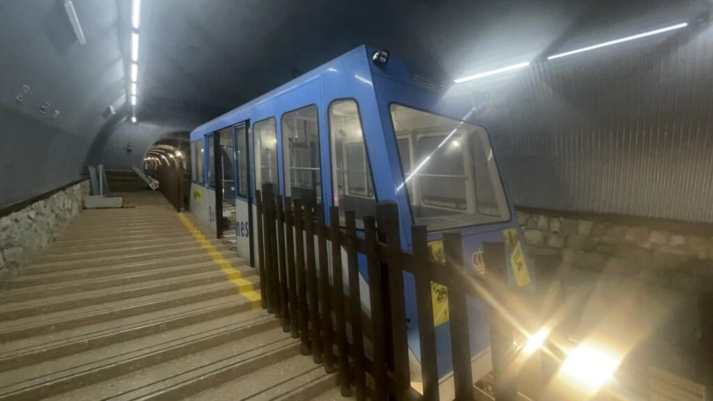
After resting in the bar, I decided to walk around Bulnes, then head down—I still had an hour and a half of hiking to reach the Cares gorge. Then I saw the funicular—but it’s not a cable car, it’s a funicular that runs on rails through a tunnel in the mountain. It’s managed by the ALSA bus company. The ticket cost the same—17 euros and I didn’t hesitate long. I bought the ticket and rode down. I had no strength left to walk another 3 km down.
When I came out, I was already close to my booked hostel. It was very convenient—I checked in, and after a shower went to the restaurant on the ground floor—they had a Menu of the Day for 18 euros. I ordered pasta with Cabrales cheese, river trout, and wine—this tough day should have been split into two, but who knew I wouldn’t make it all at once. So it is what it is.
Where to stay in Poncebos

- Hostal Poncebos ≫ – you’ll see this orange building as soon as you reach Poncebos. It’s a great hostel—I stayed here for two nights. Very clean, inexpensive, private rooms with shared facilities. The price includes a very good breakfast.
- Hotel Garganta del Cares≫ – Convenient location, bus stop nearby. Nice rooms, clean, private bathroom, quiet.
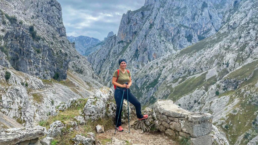
Stage 5: Ruta del Cares – Las Arenas

This day I planned to spend fully hiking the most famous route of Picos de Europa National Park—the trail along the Cares river gorge. But a month before my trip, there were big wildfires here and part of the trail was closed. The problem is limestone—it’s a very unstable rock that constantly crumbles. High temperatures caused loss of stability, and the roots of trees that held rocks were damaged. Plus, the start of rains further increased the risk of rockfalls.
Thus, the trail was closed inside, but some tourists still went anyway. In early September, a German tourist died—caught by a rockfall and could not be saved.
I decided to walk the open section out and back, just to see some of this beauty. And I don’t regret it—because even the first stage of the Ruta del Cares is incredibly beautiful!
After finishing the open section of the trail, I returned to Poncebos to catch the bus that runs between the gorge and the town of Las Arenas. I was curious here to visit the cave where Cabrales cheese is matured.
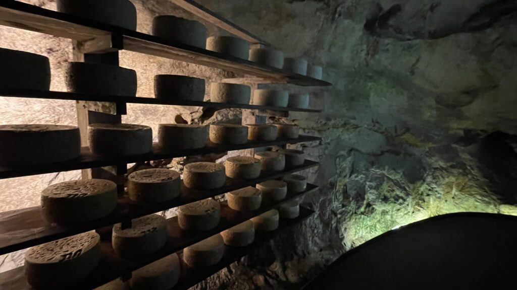
Cueva del Queso de Cabrales — the cheese cave you can tour (in Spanish, but English-speakers get a tablet with a translated tour). For 5 euros, it’s quite interesting; if you’re here, schedule a visit. You should book your tour in advance—when I arrived, the closest tour was full. So I signed up for the next time and had time for a great lunch at Sidrería La Zapica—very tasty and affordable, highly recommend.
The next day I left the Cares gorge to explore another part of the Picos de Europa—toward the Covadonga lakes.
Cangas de Onís

Cangas de Onís is more than just a town. It was the first capital of Asturias and, before the Reconquista, of all Spain. Located in the eastern part of the region, near the Picos de Europa mountains, Cangas de Onís retains the charm of a Roman settlement. Over the Sella river arches an ancient bridge, built by the Romans in the thirteenth century, now open to pedestrians.
Of course, this doesn’t cover all of the town’s landmarks. In Cangas de Onís you can see the statue of Don Pelayo, the Asturian king, the Iglesia de la Santa Cruz church dating from the eighth century, and many other buildings of historical and cultural value.

And in Cangas de Onís, you can try the best Asturian fabada—the classic dish with chorizo and blood sausage. (Though I had it elsewhere too.) At some point during your stay, be sure to drink traditional Asturian cider at a sidrería.
The town didn’t really impress me, but it’s the best base for exploring Covadonga and the northwestern part of Picos de Europa National Park. Lodging here is quite affordable, so mark it on your map when planning your route.
How to get to Cangas de Onís
I went by bus from Las Arenas (runs twice a day—check the schedule on Google). If you get to Cangas de Onís by car, there is a huge P1 Cangas Centro parking lot (Google Maps). From there, it’s only a 5-minute walk to the town center.
Next to the parking lot is the bus station, from which buses go to the Covadonga lakes. This will definitely come in handy, because driving to the lakes is prohibited by car. A ticket to the lakes costs 9 euros round trip. You can get off by the Basilica and Covadonga sanctuary on the way there or back. After exploring, just get on the next bus—the ticket covers these stops.
Covadonga – Basilica and lakes

Covadonga is a small settlement near the Picos de Europa mountain range, made famous by the first Christian victory over Muslims at the Battle of Covadonga in 722. At the beginning of the 8th century, only a narrow northern coastal strip and minor territories in the northwest remained free of the Arabs. The first resistance leader was the legendary hero Don Pelayo.

The battle is described in a Chronicle written during the reign of King Alfonso III the Great (866–910). But the account of the events is not considered entirely accurate. In truth, little is known of the causes or course of the Asturian rebellion, or of Pelayo himself. Militarily, the battle had little significance and didn’t change the situation in the country, but the ideological, religious, and psychological impact of the victory on Christians is undeniable.
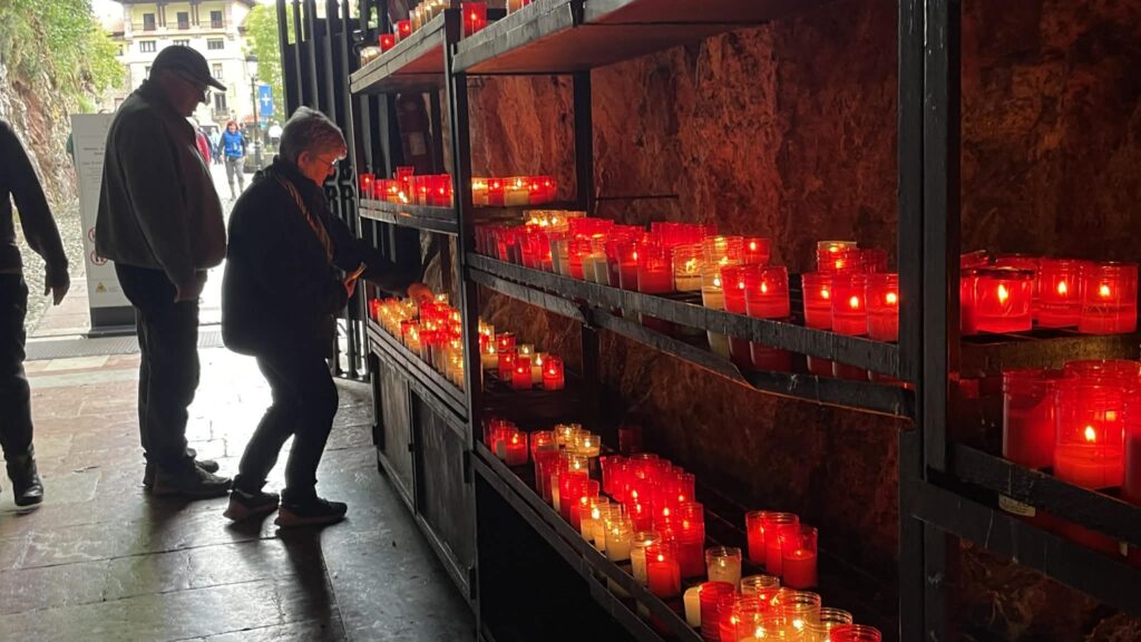
Legend says that the Virgin Mary herself stood up for Asturias, sending a sign—the appearance of a cross—before the battle began. Thus, it was from Asturias that the Reconquista began, culminating in the expulsion of the Arabs from Granada in 1492. The Virgin of Covadonga, also called the Virgin of Battles (Virgen de las Batallas), became the patroness of Asturias. In 1901, a shrine was built in the cave where Pelayo hid. The remains of Don Pelayo, his wife, and his sister are also in this cave.
There are two possible etymologies for the name Covadonga: Celtic, from “pure spring,” and Latin, as a fusion of “cova dominica”—”cave of the Holy Virgin.” Either way, the name indicates “a place of light”—and this is easy to believe, as Covadonga really is stunningly beautiful.
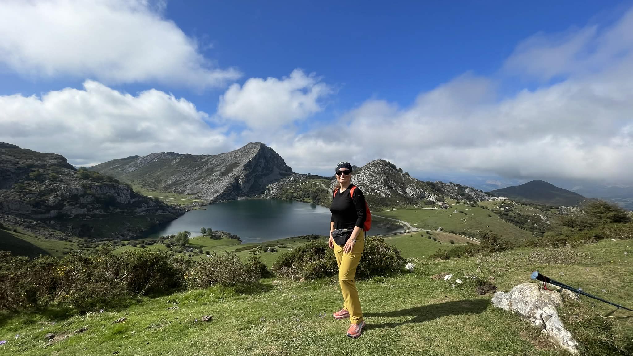
The lakes of Covadonga

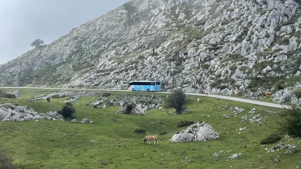
The lakes of Covadonga in the Picos de Europa National Park in Asturias have amazing high-mountain scenery, perfect for hiking. Two main glacial lakes, Enol and Ercina, are connected by a popular, easy, circular walk of about 6.5 km.
This trail, known as the “Ruta de los Lagos“, is well marked and suitable for all fitness levels, including families with children—taking about two to three hours. I did it in 1.5 hours, because I needed to catch the return bus. Most people come here for the whole day—have picnics, go hiking, just relax in the mountains.

There are longer, more challenging hikes for experienced walkers, going to remote refuges—like the trail to Mirador de Ordiales or to Vega de Ario. The beauty of hiking here lies in the variety of scenery, from lush pastures with cows to the rocky highlands with panoramic views of the surrounding landscape.
How to get to the Covadonga Lakes

Due to the lakes’ popularity, especially in peak season, access is strictly regulated for environmental protection. During periods like Holy Week, spring and autumn weekends, and from June to mid-October, private vehicles are prohibited on the road (CO-4) to the lakes (unless you arrive before 8 am).
Instead, visitors must use public buses running from the nearby town of Cangas de Onís (see details above). The bus ticket costs 9 euros for adults and 3.5 euros for children (age 4-11), kids under 3 ride free.
Parking in designated areas where you board the bus has a separate fee of about 2–3 euros. Tickets can be purchased in advance online or at the parking lots, although advance booking is highly recommended to guarantee your spot. Private vehicles are allowed outside these restricted times, but access may still be blocked if the upper parking fills up.
Viewpoints on the Picos de Europa Ring Road
Desfiladero de los Beyos—the N625 road goes north to Asturias along the contours of the impressive Beyos Gorge, formed by the Sella river. This narrow gorge is teeming with lush vegetation—the scenery here is incredible! I walked the gorge myself—highly recommend seeing and experiencing it.
The AS-114 road in northern Picos de Europa is also beautiful. Unfortunately, I traveled by bus and couldn’t stop. Here are the viewpoints where you can see stunning Picos de Europa scenery.
These are the main viewpoints along the Picos de Europa ring road, between Potes, Poncebos, and Cangas de Onís:
- Mirador del Pozo de la Oración (Google Maps): Located in the Cabrales area, here is a fantastic view of Picu Urriellu, the park’s most famous summit, rising at the valley edge. A must-visit.
- Mirador Collado de Llesba: (Google Maps) San Glorio Pass—an ancient mountain pass linking the Picos de Europa to the Spanish plateau, and this viewpoint right at Puerto de San Glorio is the perfect place to greet or say goodbye to the Picos.
- Mirador de la Cruz de Priena (Google Maps): Legend says Christian warriors defeated the Moors here in 722, starting the Reconquista. From Cruz de la Priena viewpoint, you see the secluded cave where it all happened and the Covadonga sanctuary.
- Mirador del Corzo (Google Maps)—this is a viewpoint along route N-621, marked by a statue of a deer.
- Monument to Oso Pardo (Google Maps)—a stone sculpture of a brown bear at Collado de Llesba. From Puerto de San Glorio, turn right and drive to Collado de Llesba to a small car park. The statue is a few meters away. Note: as you drive through Puerto de San Glorio, you enter León.
Useful articles and links:
- Camino de Santiago – how to prepare for the pilgrimage?
- Ruta-del-Cares – the most beautiful hike in the Picos de Europa mountains
- Mardi Himal trek – the best route for beginners in the Himalayas
- Lycian Way – a hiking route through Turkey
- 5 European hiking trails worth taking in 2026
Car rental—budget options at Rentalcars.com
Hotels—I traditionally book through Booking.com
Insurance can be bought at Hotline.Finance.