Hiking routes and trekking in Madeira are one of those things without which you won’t see the natural beauty of this island.
Thanks to Madeira’s relatively compact size, excellent road infrastructure, and the possibility to reach trails by car or public transport, this active type of recreation should definitely be included in your trip plan to Madeira.
Walk along the levadas and veredas of Madeira to discover the stunning and rugged mountain landscapes of the island, which is located in the Atlantic Ocean. Madeira is called the island of eternal spring – the Gulf Stream current provides a mild and even climate all year round.
Levadas are irrigation channels created to transport rainwater and water from natural springs from the north and west of Madeira island, where the climate is wetter and it rains more, to the south, where the weather is dry. Every levada is paired with a narrow path, which is used for walks and for discovering Madeira.
Vereda in Portuguese (also in Spanish) means “path”. This is the generic term for a walking trail in Madeira, so any track not following a levada is called a vereda. You can walk along every type of vereda in Madeira: coastal walks, mountain ridges, hikes in the Laurisilva forest, etc. Each one is stunning and unique in its own way.
Recommended reading: Madeira – 7 Day Route
New rules – Advance registration and New “Time Slot” System
Starting from January 1, 2026, you will not be able to just go on popular hiking trails on any day and time you wish. Activities in the mountains will now need to be reserved in advance. For visiting hiking routes in Madeira, including the Laurisilva forest and other natural attractions, it will become mandatory to book a specific time slot.
The Madeira government believes that such steps will regulate crowds and the number of people on the trails. Although the trails can handle daily volumes, the concentration of visitors at peak hours creates road chaos and puts pressure on the ecosystem.
How it will work
Tourists will now have to choose a specific start time for their walk.
- Platform: Slot management will be handled through the SIMplifica platform.
- Strict limits: Each time period will have a maximum number of visitors. If that time slot is full, you’ll need to select an earlier or later time.
- Support: The Institute of Forests and Nature Conservation (IFCN) is launching a new app and updating its website to reflect real-time availability.
What about residents? The secretary emphasized that this rule will affect absolutely everyone. However, Madeira residents will still be able to enjoy the mountains for free, although they will still be subject to the new organizational rules.
You must plan your Madeira hikes in advance. Spontaneous trips to the peaks will now be much harder to pull off. With strict time slots, punctuality is key.
So now it won’t work to just check the weather and pick the sunniest part of the island that day for hiking. Everything must be planned, unfortunately….
How much does hiking in Madeira cost

Until 2025, hiking in Madeira was free. From January 1, 2025, some hiking trails have become paid. Walking any of these trails costs €3 per person older than 12 | Children under 12 and Madeira residents – free. The fee can be paid in advance via the SIMplifica portal, or users can pay on site using their own electronic device.
This is a charge for garbage collection and maintenance of classified hiking routes. This fee is not accident insurance! The user is personally and solely responsible for any property or personal damage caused while using the trail.
There aren’t ticket offices on every trail (a ticket checker stands at the trailhead) – only at super-popular routes like Levada do Caldeirão Verde or PR1.2 – Pico Ruivo. There’s a big flow of visitors and they check tickets (if you bought them online), or sell tickets on site for cash.
Here is a list of paid trails in Madeira (the fee applies to each trail, even if you hike several in one day):
- PR1 – Areeiro Vereda
- PR1.2 – Pico Ruivo Vereda
- PR 6.1 – Levada do Risco
- PR 8 – Vereda Ponta de São Lourenço Footpath
- PR 9 – Levada do Caldeirão Verde
- PR 11 – Vereda dos Balcões
- PR 18 – Levada do Rei
PR9 – Levada do Caldeirão Verde
Difficulty: *
Distance: 13 kilometers
Duration: 4-5 hours with breaks for snacks and photos
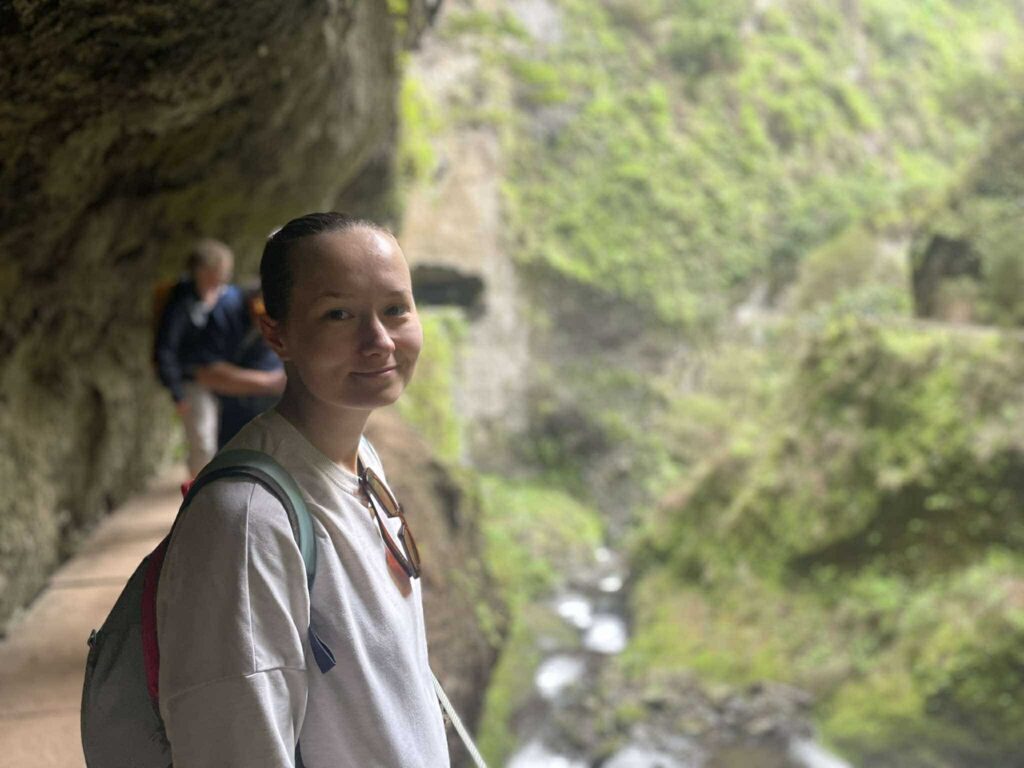
Discover the magical trail Levada do Caldeirão Verde, a hidden gem of Madeira. This 13-kilometer out-and-back trek, starting at Queimadas Forestry park near Santana, offers hikers a moderate but unforgettable adventure.
The trail winds through lush valleys, dramatic cliffs, and tunnels, leading to the breathtaking Caldeirão Verde waterfall. This route is perfect for nature lovers. Don’t forget a flashlight for the tunnels and sturdy hiking boots with a non-slip sole. It’s always wet here because of numerous large and small waterfalls, and in rainy weather the trail gets muddy.
As mentioned, a unique aspect of this hike is all the tunnels you pass through on the way to the main waterfalls! Some are several hundred meters long. While passing through, keep an eye on your head as the “ceilings” are quite low in some places.
Halfway (6 km) you reach the main waterfall (Green Cauldron), an epic spot to rest and have lunch. Note that due to a landslide in recent years, there are signs indicating that the path to the main waterfall is closed. If you’re motivated, you can continue another 2.4 km to the second waterfall called Caldeirão Do Inferno. This will probably add another two hours to your hike but is worth it if you have the time.
How to get to the trail:
- Take a bus to Santana, then a taxi or walk to the Queimadas Forest Park.
- It’s easier by car – parking is in front of the trailhead here. Parking costs 2 euro per hour.
Levada Nova and Levada do Moinho
Difficulty: *
Distance: 13 kilometers
Duration: 4-5 hours with breaks for snacks and photos

We mixed two levadas, as we wanted to hike to the waterfalls of Levada Nova but not return along the same path.
So, Levada Nova starts in the town of Lambada – in one direction it’s just 3 km, but offers beautiful views. At the end, in the gorge after passing a long dark tunnel (bring flashlights) you’ll find a huge two-tiered waterfall. By the way, the trail runs underneath this waterfall, which is a stunning experience!
Levada do Moinho runs parallel at a different elevation, is 10.5 km long, starting near regional road ER 101 which separates the municipalities of Porto Moniz and Calheta, near Ribeira-da-Cruz. You can walk one way on Levada Nova. If you don’t want to return the same way, you can go down and make the return by Levada do Moinho.

Choosing a separate walk along PR 7 Levada do Moinho, you’ll get a direct look at the island’s natural and historic wealth. Levada do Moinho (also called Levada Grande) owes its name to the fact that there were several water mills along its route supplied by the levada.
You can still find some of their ruins, such as the Achadas mill, Cancelas mill, and Levada Grande mill. This moderate route ends, almost at the finish, with direct contact with the green Laurissilva zone. The surroundings of Levada do Moinho, ending in Tornaduru, in Junqueira, are often intersected by branches of the “levada” that bring water to irrigation tanks.
How to get to Levada Nova
- By car – head to the village of Lombada da Ponta do Sol. The trailhead is near Igreja da Lombada – here’s a small parking lot, or you can park along the road above. We started our hike from the opposite side – here, which has more space for cars. We walked the upper part first, then descended to the church.
- If you’re without a car – use Rodoeste buses to reach Ponta do Sol. Once you’re in Ponta do Sol, you may want to take a taxi to the trailhead in Lombada da Ponta do Sol, which is nearby.
PR1.2 – Pico Ruivo
Difficulty: *
Distance: 5.6 km round trip
Duration: 2 hours with a coffee break

Set out on an exciting hike from the parking lot at Achada do Teixeira to Pico Ruivo – the highest peak of Madeira. This 5.6 km out-and-back trip offers a moderately difficult climb with panoramic views of the island’s mountains.

This trail promises stunning views and unforgettable impressions on the way to the summit and at the summit itself. Perfect for both experienced hikers and beginners, the route showcases Madeira’s gorgeous landscapes and diverse flora.
There is a mountain shelter on the route, where you can pause for coffee – free toilet available. Or just sit a while and rest in the sun.
How to get to the trail:
- From Achada do Teixeira to Pico Ruivo: take a bus to Santana, then a taxi or hike to Achada do Teixeira. From Santana it’s around 30 euros by car.
- By car – from Santana take the narrow but good road to the parking lot at Achada do Teixeira, from Funchal you drive on the ER103 via Santana. The parking is large and free.
PR8 – Ponta de São Lourenço
Difficulty: **
Distance: 8 km round trip
Duration: 3.5 hours with a coffee break

Experience an unforgettable adventure along the dramatic cliffs of Ponta de São Lourenço in Madeira. This iconic peninsula provides a stunning contrast to the island’s lush mountainous landscapes. The peninsula has impressive rock formations and breathtaking ocean views.
Start your hike from the parking lot at the trailhead (there’s also a bus stop here). As you cover the rugged terrain, you’ll find unique flora and fauna adapted to the dry climate. In the dry season, the peninsula is brick brown because it is covered in clay, but in winter, it’s cloaked in green grass and has a very beautiful emerald tint.

The trek might seem easy, but at the finish you face a pretty steep climb to the viewpoint, so prepare to sweat a bit to get to the top. In terms of safety, the trail feels well protected. The edges in open sections are roped off or the trail is wide enough to feel completely safe.
There is a cafe along the trail, where you can get coffee, poncha, or order lunch. Prices are the same as in Funchal. There is a paid toilet.

Note: if you get caught in the rain on this trail, it can be dangerous because the clay turns very slippery. Even in hiking boots it was difficult to descend when a cloud suddenly appeared and poured rain on us at the last steps. Be careful, bring a raincoat, and wear shoes with good tread.
Tip: Always check the weather forecast before heading out – as we did. But also remember that the weather can change quickly. This part of the island is known for its changeable weather, so it all comes down to what happens any given day.
Don’t miss the chance to snap phenomenal photos of the dramatic coastline and the blue water below, as well as a shot at the end of the trail – with a view of the ocean and lighthouse at the tip of the cape.
How to get to the trail:
- By car to the trailhead – there is free parking here, which often fills up, so cars are parked along the road and that’s normal (as all over the island).
- You can reach the trailhead by bus SAM No. 113. But you need the one that goes to the last stop, Baia D’Abra.
PR11 – Vereda dos Balcões
Difficulty: *
Distance: 3 km round trip
Duration: 1 hour

Feel the beauty of Madeira’s nature on the Vereda dos Balcões trail. This picturesque route starts at Ribeiro Frio and takes hikers through lush forests. At the end, hikers enjoy stunning views of the island’s valleys and peaks.

This is a very simple excursion for nature lovers seeking relaxation. Don’t forget your camera to snap photos along the way. You can also see birds eating grain right from people’s hands. At the trailhead you can buy birdseed and feed the local sparrows by hand.
How to get to the trail:
- No buses go here – you can reach it by car from Funchal or Faial via the ER103 road. It’s an old narrow but normal road winding through the mountains between the two towns.
PR 13 – Vereda do Fanal
Difficulty: **
Distance: 11 km out-and-back
Duration: 4 hours with snack break

Starting from the Paul da Serra plateau (Assobiadores), on the regional road ER 209, Vereda do Fanal is 10.8 km with a recommended duration of 4 hours, offering hikers the chance to cross a widespread green zone of local Laurisilva forest.
This forested area, endemic to Madeira and a UNESCO World Heritage Site, is in ideal condition for conservation and development. It’s a wonderful natural landscape seen on many Madeira postcards: old trees draped in moss, clouds that hug this part of the highlands.

Along the path, in the area known as “sítio do Fio”, you can see the cable system built for transporting wood and brush from the Fanal area to Chão da Ribeira and Seixal. This moderate Vereda do Fanal ends at Fanal, where you’ll find a small volcanic crater – a real haven for rest and silence. It’s the perfect place to relax, enjoying the views of the natural surroundings of age-old laurel woods (Ocotea foetens), some of which were here before the island was discovered.
How to get to the Fanal forest:
- Take a Rodoeste bus from Funchal toward Ribeira da Janela or Porto Moniz. These routes pass through Paul da Serra plateau, where you can get off at Assobiadores. Rodoeste buses are the main public transport to reach this area. Check schedules on the Rodoeste website or at local bus stops in Funchal.
- You can come by rental car – free parking here.
- Or buy a ready-made tour by bus, or with a small company by jeep, which can also include other sites in the island’s north.
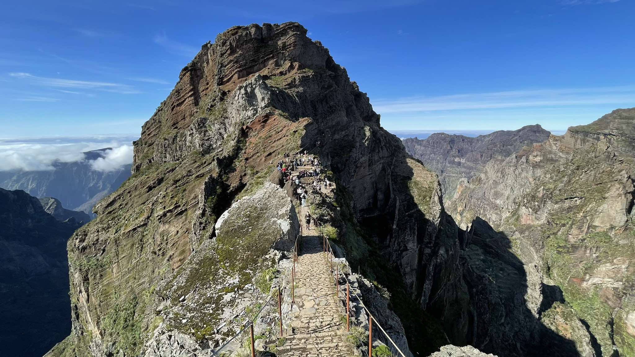
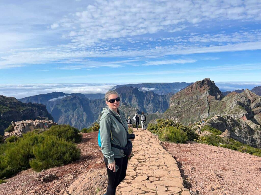
PR1 – Pico do Arieiro to Pico Ruivo
Difficulty: ***
Distance: 11 km round trip
Duration: 5-7 hours with food and photo stops

This route was still undone (we only walked the first 1.2 km) – in 2025 it was closed due to past fires on the trail. And that’s a good reason to return to Madeira once more.
The Pico do Arieiro to Pico Ruivo hike is probably the most famous and popular mountain trek in Madeira. And rightly so. The trail is accessible from Funchal and you can basically drive to the summit of Pico do Arieiro for sunrise or sunset, as most people do every day.

It’s better to check the webcam at Arieiro before heading up (for sunrise, of course, there’s no sense in checking since the image will be black). In terms of dramatic scenery, the sunrise views from Arieiro are hard to beat. The whole internet is flooded with photos of this beauty.
Route features
As for the route – the most common version is to hike up to Pico Ruivo and return:
Arieiro – Ruivo – Arieiro. This is about 11 km with an altitude gain of 800–850 m along the way. Time-wise, plan on 5-7 hours round trip, depending on your pace and hiking experience.
However, it is possible to do this hike one way to Encumeada. Or finish at Achada do Teixeira below the Ruivo summit, though both require solving the logistics of returning to your car at Arieiro.

Overall, the Arieiro – Ruivo route is well maintained with well-laid stone paths and stairs. Approaching Ruivo you’ll find some sections with steep staircases. They sometimes feel endless and really steep in places. But although tiring, it won’t be too hard for the average hiker.
Note along the trail there are several dark tunnels you’ll need to go through, so bring a headlamp (if it’s reopened and you do the full route).

The Pico Ruivo summit can be chilly and a bit windy, so be sure to bring a jacket, and a buff or hood for your head.
A little below the Pico Ruivo summit is a nice café where you can have lunch in the sun or inside (if it’s not sunny) and buy coffee or beer.
How to get to the trail:
- By car – from Funchal it’s about 1 hour; from other towns, the road goes through Funchal anyway. So plan this visit for when you are on the southern coast. Parking at the trailhead is very small and very expensive – 4 euros per hour, 20 euros for the day. There’s a cheaper parking lot further down – 5 euros per day. There are very few spots at these lots, especially on good weather days. People park along the road (that’s free, but police may fine cars that obstruct traffic – we parked so we didn’t bother anyone).
- Some people get to Pico do Arieiro partly by bus: they take the bus to Paso do Poiso pass, then hitch a ride from passing cars up to Pico do Arieiro.
Planning & Preparation

Research and Maps :
Use apps like Maps.me or AllTrails for detailed route maps and offline navigation. Get a local hiking map at the tourist office or bookstore in Funchal.
Weather and Equipment :
The weather in Madeira can be unpredictable. Before visiting any part of the island, it’s best to plan using the IPMA-Madeira website. Dress in layers and take waterproof gear. Wear sturdy hiking shoes and bring plenty of water and snacks.
Accommodation :
Consider staying in different parts of the island for easier access to various hiking areas. Funchal is a good base, with excellent bus connections to many hiking routes.
Recommended reading: Where to stay in Madeira – areas, travel styles, and insider advice
Emergency Numbers :
Save local emergency numbers on your phone. The European emergency number 112 works on Madeira as well.
With careful planning and by using public transport and other services, you can enjoy Madeira’s diverse and beautiful hiking trails without needing a car.
Car Rental in Madeira
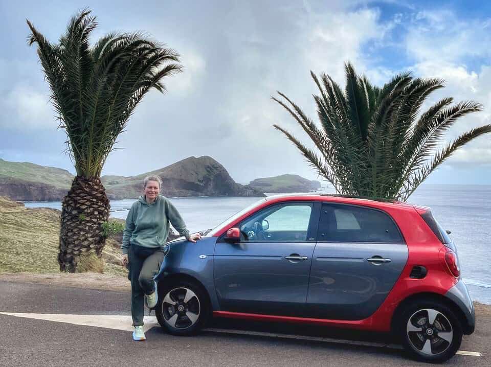
The best way to get around Madeira is by car. Most visitors rent a car, and I recommend doing the same (if you have a driver’s license – a Ukrainian plastic one is enough). Car rental is a convenient option for travelers anywhere, but in Madeira it’s different: it’s almost a necessity rather than a choice.
Fortunately, the island is served by plenty of car rental companies, some right at the airport.
The best place to choose a car is Rentalcars.com – here you have a wide range of suppliers, can check reviews and compare terms and prices.
Public Transport
- Green buses SAM go to and from the airport and cover east and northeast routes.
- Yellow buses Horarios do Funchal are great for getting around the main city of Funchal, as well as the center and northeast.
- Red buses Rodoeste cover the center, west, north and northwest.
- Maroon buses Eacl work for the eastern suburbs of Funchal.
Excursions and Transfers
Guided hiking tours:
- Many companies offer guided walking tours with transport to and from the trailhead. Convenient if you want to explore without worrying about logistics.
- Examples are Madeira Explorers, WalkMe Madeira, and Madeira Island Tours.
Taxi and transfer services :
- Taxis are easy to find and can be hired for one-way or round-trip rides to trailheads. Agree on the fare beforehand.
- Some companies offer special transfer services to popular trails.
Useful articles and links:
- Beaches in October – where to relax at the end of velvet season
- Heading to Madeira – Island Guide
- Alentejo coast – where to find Portugal’s most beautiful wild beaches
- Rota Vicentina – hike along the ocean
Car rental – affordable options always available on the Rentalcars.com aggregator
Green Card and travel medical insurance for trips abroad – online at HotlineFinance
Hotel and apartment bookings – Booking.com